Mostrando entradas con la etiqueta The Water. Mostrar todas las entradas

domingo, 11 de junio de 2017

the National Science Foundation (NSF) : Discovery .- World Oceans Day: How do snook survive cold spells in Everglades waters? By heading for the depths .- Día Mundial de los Océanos: ¿Cómo sobreviven los róbalos a hechizos fríos en las aguas de los Everglades? Al dirigirse a las profundidades

https://www.nsf.gov/discoveries/disc_images.jsp?cntn_id=241892&org=NSF

An animal's location at any given moment could be the difference between life and death
La ubicación de un animal en cualquier momento podría ser la diferencia entre la vida y la muerte
Mangroves (green) and freshwater marshes (light brown) surround the upper Shark River.

Mangroves (green) and freshwater marshes (light brown) surround the upper Shark River.
Credit and Larger Version

June 8, 2017

When a cold spell strikes the tropics, an animal's location at any given moment could be the difference between life and death.
That was the case with a Florida Everglades fish called a common snook when a cold snap struck in 2010, scientists report today -- World Oceans Day -- in the journal Global Change Biology.
"If we look at the average temperatures throughout the entire ecosystem during the cold spell, no snook should have survived," said Ross Boucek, a biologist with Bonefish & Tarpon Trust who conducted the study while at Florida International University (FIU). "But if you zoom in on temperatures in different habitats, you see certain features that allowed a few habitats to stay warm enough for some fish to make it out alive."
Deeper water helps keep water temperature constant; those locations are where the snook waited out the cold.
At the top of an estuary like the Everglades' Shark River, where researchers performed their study, habitats are shallower with less salt. At the bottom, where habitats are deeper with saltier water, the colder surface water is less likely to mix in.
Snook exposure to potentially lethal cold anomalies is governed not only by fish behavior, but by cold and warm water mixing due to winds, river flow, tides and water depth, according to Tom Torgersen, program director for the National Science Foundation's (NSF) Water Sustainability and Climate program, which supported the research at NSF's Florida Coastal Everglades Long-Term Ecological Research (LTER) site.
The site is one of 28 such NSF LTER sites in ecosystems from wetlands to coral reefs, grasslands to deserts.
"The effect on snook of any single extreme event should be viewed in terms of the physical conditions in which it happened, as well as the biological processes that affect snook distribution," said Torgersen.
According to Jennifer Rehage, an FIU ecologist, if researchers understand what keeps water temperatures warmer, and how and why snook seek refuge in those habitats, resource managers can understand the snooks' vulnerability and manage the fish population accordingly.
Although further research is needed, the scientists suggest that more freshwater flow could help push snook to warmer habitats, potentially reducing mortalities and better sustaining fisheries when cold spells strike.
Florida Coastal Everglades LTER monitoring networks provided the scientists with long-term data on environmental conditions. The scientists outfitted more than 100 snook with acoustic transmitters, following their movements throughout the Everglades.
"Sudden changes in water temperature due to cold snaps may have lethal effects on many economically important species of fish and other marine creatures," said NSF LTER program director David Garrison. "By understanding what drives species distribution patterns in these circumstances, fisheries management plans can be adjusted accordingly."
The Everglades Foundation also funded the research.
-- Cheryl Dybas, NSF (703) 292-7734
cdybas@nsf.gov
-- Evelyn Gonzalez, FIU (305) 348-4493
 esgonzal@fiu.edu

Investigators
Mahadev Bhat 
Rudolf Jaffe 
Michael Sukop 
Jennifer Rehage 
Pallab Mozumder 

Related Institutions/Organizations
Florida International University

Related Awards

Total Grants
$1,540,583

Related Websites
NSF Florida Coastal Everglades LTER Site:
 http://fce.lternet.edu/
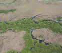
Detail of small creeks where freshwater marshes (brown) and mangroves (green) meet.
Credit and Larger Version
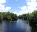
Common snook habitat in the upper Shark River in Everglades National Park.
Credit and Larger Version
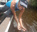
Scientist Jennifer Rehage holds a young common snook.
Credit and Larger Version
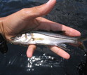
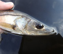
Image of an Everglades common snook, less than a year old.
Credit and Larger Version
Picture of a juvenile common snook in Tarpon Bay, Everglades National Park.
Credit and Larger Version
The National Science Foundation (NSF)
Guillermo Gonzalo Sánchez Achutegui
ayabaca@gmail.com
ayabaca@hotmail.com
ayabaca@yahoo.com
Inscríbete en el Foro del blog y participa : A Vuelo De Un Quinde - El Foro!

viernes, 1 de abril de 2016

NASA : Greenland's Ice Sheet From 40,000 Feet .- Capa de hielo de Groenlandia de 40.000 pies

Hola amigos: A VUELO DE UN QUINDE EL BLOG.,  The Oceans Melting Greenland (OMG) field : El equipo de campaña de campo está volando la aeronave G-III de la NASA en cerca de 40.000 pies. En un día claro, esta altitud también proporciona una perspectiva impresionante de uno de los dos grandes capas de hielo del mundo (la otra es la Antártida). El vuelo sábado por la 26 de marzo sobre la costa noreste era uno de esos días claros.
El equipo de OMG es ahora sólo unos pocos vuelos de distancia de la cartografía de las alturas de los glaciares alrededor de toda la costa de Groenlandia. Estas medidas formarán la base de este primero de su clase experimento, aclarar la imagen de cómo los glaciares de Groenlandia están respondiendo a un momento en que muchas señales apuntan a que la aceleración del cambio
More information.............
http://www.nasa.gov/image-feature/greenlands-ice-sheet-from-40000-feet

Ice sheet of Greenland photographed from aircraft
The Oceans Melting Greenland (OMG) field campaign team is flying NASA’s G-III aircraft at about 40,000 feet. On a clear day, this altitude also provides a stunning perspective of one of the world’s two great ice sheets (the other is Antarctica). The flight Saturday, March 26, over the northeast coastline was one of those clear days.

The OMG team is now just a few flights away from mapping glacier heights around the entire coast of Greenland. These measurements will form the baseline of this first-of-its-kind experiment, clarifying the picture of how Greenland’s glaciers are responding at a time when many signs point to accelerating change.

OMG will pave the way for improved estimates of sea level rise by investigating the extent to which the oceans are melting Greenland’s ice. OMG will observe changing water temperatures and glaciers that reach the ocean around all of Greenland from 2015 to 2020.
Image Credit: NASA
Last Updated: March 29, 2016
Editor: Sarah Loff
NASA
Guillermo Gonzalo Sánchez Achutegui
ayabaca@gmail.com
ayabaca@hotmail.com
ayabaca@yahoo.com
Inscríbete en el Foro del blog y participa : A Vuelo De Un Quinde - El Foro!

domingo, 8 de marzo de 2015

NASA : NASA Research Suggests Mars Once Had More Water than Earth’s Arctic Ocean .- NASA, sugiere que alguna vez hubo agua en Marte tanto como el Polo Ärtico de La Tierra.

Hola amigos: A VUELO DE UN QUINDE EL BLOG., hemos recibido información de la Agencia Espacial NASA, que según ellos hubo agua en Marte tanto como lo hay en el Polo Ártico de La Tierra. Un primitivo océano en Marte llevó a cabo más agua que el Océano Ártico de la Tierra, según los científicos de la NASA que, utilizando los observatorios terrestres, firmas de agua medidos en la atmósfera del planeta rojo.
Los científicos han estado buscando respuestas a por qué este vasto suministro de agua salió de la superficie. Los detalles de las observaciones y cálculos aparecen en la edición del jueves de la revista Science.
https://www.nasa.gov/press/2015/march/nasa-research-suggests-mars-once-had-more-water-than-earth-s-arctic-ocean

Mars once held more water than Earth's Arctic Ocean
NASA scientists have determined that a primitive ocean on Mars held more water than Earth's Arctic Ocean and that the Red Planet has lost 87 percent of that water to space.
Image Credit: 
NASA's Goddard Space Flight Center
Feature Link: 
A primitive ocean on Mars held more water than Earth’s Arctic Ocean, according to NASA scientists who, using ground-based observatories, measured water signatures in the Red Planet’s atmosphere.
Scientists have been searching for answers to why this vast water supply left the surface. Details of the observations and computations appear in Thursday’s edition of Science magazine.
“Our study provides a solid estimate of how much water Mars once had, by determining how much water was lost to space,” said Geronimo Villanueva, a scientist at NASA’s Goddard Space Flight Center in Greenbelt, Maryland, and lead author of the new paper. “With this work, we can better understand the history of water on Mars.”
Perhaps about 4.3 billion years ago, Mars would have had enough water to cover its entire surface in a liquid layer about 450 feet (137 meters) deep. More likely, the water would have formed an ocean occupying almost half of Mars’ northern hemisphere, in some regions reaching depths greater than a mile (1.6 kilometers).
The new estimate is based on detailed observations made at the European Southern Observatory’s Very Large Telescope in Chile, and the W.M. Keck Observatory and NASA Infrared Telescope Facility in Hawaii. With these powerful instruments, the researchers distinguished the chemical signatures of two slightly different forms of water in Mars’ atmosphere. One is the familiar H2O. The other is HDO, a naturally occurring variation in which one hydrogen is replaced by a heavier form, called deuterium.
By comparing the ratio of HDO to H2O in water on Mars today and comparing it with the ratio in water trapped in a Mars meteorite dating from about 4.5 billion years ago, scientists can measure the subsequent atmospheric changes and determine how much water has escaped into space.
The team mapped H2O and HDO levels several times over nearly six years, which is equal to approximately three Martian years. The resulting data produced global snapshots of each compound, as well as their ratio. These first-of-their-kind maps reveal regional variations called microclimates and seasonal changes, even though modern Mars is essentially a desert.
The research team was especially interested in regions near Mars’ north and south poles, because the polar ice caps hold the planet’s largest known water reservoir. The water stored there is thought to capture the evolution of Mars’ water during the wet Noachian period, which ended about 3.7 billion years ago, to the present.
From the measurements of atmospheric water in the near-polar region, the researchers determined the enrichment, or relative amounts of the two types of water, in the planet’s permanent ice caps. The enrichment of the ice caps told them how much water Mars must have lost – a volume 6.5 times larger than the volume in the polar caps now. That means the volume of Mars’ early ocean must have been at least 20 million cubic kilometers (5 million cubic miles).
Based on the surface of Mars today, a likely location for this water would be in the Northern Plains, considered a good candidate because of the low-lying ground. An ancient ocean there would have covered 19 percent of the planet’s surface. By comparison, the Atlantic Ocean occupies 17 percent of Earth’s surface.
“With Mars losing that much water, the planet was very likely wet for a longer period of time than was previously thought, suggesting it might have been habitable for longer,” said Michael Mumma, a senior scientist at Goddard and the second author on the paper.
NASA is studying Mars with a host of spacecraft and rovers under the agency’s Mars Exploration Program, including the Opportunity and Curiosity rovers, Odyssey and Mars Reconnaissance Orbiter spacecraft, and the MAVEN orbiter, which arrived at the Red Planet in September 2014 to study the planet’s upper atmosphere.
In 2016, a Mars lander mission called InSight will launch to take a first look into the deep interior of Mars. The agency also is participating in ESA’s (European Space Agency) 2016 and 2018 ExoMars missions, including providing telecommunication radios to ESA’s 2016 orbiter and a critical element of the astrobiology instrument on the 2018 ExoMars rover. NASA’s next rover, heading to Mars in 2020, will carry instruments to conduct unprecedented science and exploration technology investigations on the Red Planet.
NASA’s Mars Exploration Program seeks to characterize and understand Mars as a dynamic system, including its present and past environment, climate cycles, geology and biological potential. In parallel, NASA is developing the human spaceflight capabilities needed for future round-trip missions to Mars in the 2030s.
To view a video of this finding, visit:
More information about NASA's Mars programs is online at:
NASA
TRADUCCIÓN AL ESPAÑOL :

La investigación de la NASA sugiere que Marte tuvo una vez más agua que el océano Ártico de la Tierra
Un océano primitivo en Marte contenía más agua que el Océano Ártico de la Tierra, de acuerdo con científicos de la NASA que, utilizando observatorios terrestres, midieron las firmas de agua en la atmósfera del Planeta Rojo.
Los científicos han estado buscando respuestas a por qué este vasto suministro de agua salió de la superficie. Los detalles de las observaciones y los cálculos aparecen en la edición del jueves de la revista Science.
"Nuestro estudio proporciona una estimación sólida de la cantidad de agua que alguna vez tuvo Marte, determinando cuánta agua se perdió en el espacio", dijo Gerónimo Villanueva, científico del Centro de Vuelos Espaciales Goddard de la NASA en Greenbelt, Maryland, y autor principal del nuevo documento. . "Con este trabajo, podemos comprender mejor la historia del agua en Marte".
Tal vez hace unos 4.3 mil millones de años, Marte habría tenido suficiente agua para cubrir toda su superficie en una capa líquida de unos 450 pies (137 metros) de profundidad. Lo más probable es que el agua habría formado un océano que ocupa casi la mitad del hemisferio norte de Marte, en algunas regiones que alcanzan profundidades de más de una milla (1,6 kilómetros).
La nueva estimación se basa en observaciones detalladas realizadas en el Very Large Telescope del Observatorio Europeo Austral en Chile y en el W.M. Observatorio Keck y la instalación del telescopio infrarrojo de la NASA en Hawai. Con estos potentes instrumentos, los investigadores distinguieron las firmas químicas de dos formas ligeramente diferentes de agua en la atmósfera de Marte. Uno es el H2O familiar. El otro es HDO, una variación natural en la cual un hidrógeno es reemplazado por una forma más pesada, llamada deuterio.
Al comparar la relación de HDO a H2O en agua en Marte hoy y compararla con la proporción en agua atrapada en un meteorito de Marte que data de hace unos 4.500 millones de años, los científicos pueden medir los cambios atmosféricos posteriores y determinar cuánta agua escapó al espacio .
El equipo asignó niveles de H2O y HDO varias veces durante casi seis años, lo que equivale a aproximadamente tres años marcianos. Los datos resultantes produjeron instantáneas globales de cada compuesto, así como su proporción. Estos primeros mapas de su clase revelan variaciones regionales llamadas microclimas y cambios estacionales, a pesar de que el Marte moderno es esencialmente un desierto.
El equipo de investigación se interesó especialmente en las regiones cercanas a los polos norte y sur de Marte, porque los casquetes polares contienen el depósito de agua más grande conocido del planeta. Se cree que el agua almacenada allí captura la evolución del agua de Marte durante el húmedo período Noachian, que terminó hace unos 3.700 millones de años, hasta el presente.

A partir de las mediciones del agua atmosférica en la región casi polar, los investigadores determinaron el enriquecimiento, o cantidades relativas de los dos tipos de agua, en las capas de hielo permanentes del planeta. El enriquecimiento de las capas de hielo les indicó la cantidad de agua que debe haber perdido Marte, un volumen 6.5 veces mayor que el volumen en las capas polares ahora. Eso significa que el volumen del océano temprano de Marte debe haber sido de al menos 20 millones de kilómetros cúbicos (5 millones de millas cúbicas).
Con base en la superficie de Marte actual, una ubicación probable para esta agua sería en las Planicies del Norte, considerado un buen candidato debido a la baja altitud del terreno. Un océano antiguo habría cubierto el 19 por ciento de la superficie del planeta. En comparación, el Océano Atlántico ocupa el 17 por ciento de la superficie de la Tierra.
"Con Marte perdiendo tanta agua, el planeta probablemente estuvo mojado durante un período de tiempo más largo de lo que se pensaba, sugiriendo que podría haber sido habitable durante más tiempo", dijo Michael Mumma, un científico de Goddard y el segundo autor en el papel.
La NASA está estudiando Marte con una hueste de vehículos espaciales y exploradores bajo el Programa de Exploración de Marte, incluidos los vehículos exploradores Opportunity y Curiosity, Odyssey y Mars Reconnaissance Orbiter, y el orbitador MAVEN, que llegó al planeta rojo en septiembre de 2014 para estudiar el planeta atmósfera superior.
En 2016, se lanzará una misión de aterrizaje de Marte llamada InSight para echar un primer vistazo al interior profundo de Marte. La agencia también participa en las misiones ExoMars de la ESA (Agencia Espacial Europea) de 2016 y 2018, incluida la provisión de radios de telecomunicaciones para el orbitador de la ESA en 2016 y un elemento crítico del instrumento de astrobiología en el rover ExoMars 2018. El próximo explorador de la NASA, que se dirigirá a Marte en 2020, llevará instrumentos para llevar a cabo investigaciones científicas y de tecnología de exploración sin precedentes en el planeta rojo.
El Programa de Exploración de Marte de la NASA busca caracterizar y entender a Marte como un sistema dinámico, que incluye su entorno presente y pasado, los ciclos climáticos, la geología y el potencial biológico. En paralelo, la NASA está desarrollando las capacidades de vuelos espaciales humanos necesarios para futuras misiones de ida y vuelta a Marte en la década de 2030.
NASA
Guillermo Gonzalo Sánchez Achutegui
Inscríbete en el Foro del blog y participa : A Vuelo De Un Quinde - El Foro!

martes, 5 de agosto de 2014

NASA : NASA Glenn and Partners Studying Lake Erie Algal Bloom


Glenn's S-3 Aircraft in flight
NASA Glenn's S-3 aircraft is one of the Center's multi-mission airborne research platforms.
Image Credit: 
NASA Glenn Research Center
 
 
Engineers at NASA's Glenn Research Center in Cleveland are using NASA Glenn remote sensing technology, previously developed for Mars exploration, to learn more about the Lake Erie algal bloom that contaminated water supplies in northwestern Ohio and southeastern Michigan over the weekend.
Deploying a hyper-spectral imager and miniature spectrometers aboard Glenn’s S-3 aircraft, which begins the flight campaign today, researchers from Glenn; the National Oceanic and Atmospheric Administration Great Lakes Environmental Research Laboratory (GLERL) in Ann Arbor, Michigan and the U.S. Naval Research Laboratory in Washington, D.C. are using the high resolution instruments to capture images that will reveal western Lake Erie’s characteristics across the light spectrum.  Each aquatic component of the lake has a unique spectrographic signature.  By studying these signatures, researchers can continually improve their ability to remotely identify the biochemical properties of an algal bloom and predict when and where they will form.
"Fresh water is one of Earth’s most precious commodities and is essential to our civilization’s survival,” said John Lekki, an optical systems research engineer at Glenn.  “Our collaboration with NOAA, and now the U.S. Naval Research Lab in this effort, will increase our understanding of how to confront this significant environmental and human health threat.”
NASA and NOAA satellite imagery is currently used to identify, monitor and map potentially harmful algal blooms.  However, varying weather conditions may obscure a satellite’s imaging capability during a scheduled pass.  The use of airborne remote-sensing instruments supplements satellite imagery and helps provide continual monitoring of algal blooms even when cloud cover is prevalent.  The use of remote-sensing equipment could also be beneficial in other parts of the world where satellite imagery is not available and algal blooms are an issue.
 
Algae Bloom on Lake Erie
The Moderate Resolution Imaging Spectroradiometer (MODIS) on NASA’s Aqua satellite captured this natural-color view of an algae bloom in the west end of Lake Erie. The image of the coastal waters off of Ohio, Michigan, and southwestern Ontario was acquired at 2:50 p.m. EST on August 3, 2014.
Image Credit: 
NASA Goddard Space Flight Center
 
 
Once analyzed, the data collected through this research will be publicly available to those with an interest in algal blooms. 
“NOAA, NASA and the U.S. Naval Research Lab have the expertise and resources uniquely suited to tackle this issue,” said George Leshkevich, a physical scientist with the GLERL.  “Getting this higher resolution data on Lake Erie will help us better understand the characteristics of the current bloom and improve our satellite detection methods to pinpoint where and when future blooms will occur.”
The remote-sensing project is sponsored by NASA's Applied Sciences Program in the Earth Science Division at NASA Headquarters, Washington. NASA monitors Earth's vital signs from land, air and space with a fleet of satellites and ambitious airborne and ground-based observation campaigns. NASA develops new ways to observe and study Earth's interconnected natural systems with long-term data records and computer analysis tools to better see how our planet is changing. The agency shares this unique knowledge with the global community and works with institutions in the United States and around the world that contribute to understanding and protecting our home planet.
Over the past several weeks, researchers from Glenn and GLERL have been testing the remote­ sensing system mounted on the S-3.  Previous remote-sensing research flights with NOAA took place in 2007.
Additional partners in the latest algal bloom flight research campaign include Kent State University in Kent, Ohio, the University of Toledo in Toledo, Ohio and Michigan Tech Research Institute in Ann Arbor, Mich.
For more information on NASA Glenn Research Center, visit:
For more information on NASA Earth science activities, visit:
For more information on NOAA, visit:
NASA
Guillermo Gonzalo Sánchez Achutegui

viernes, 27 de septiembre de 2013

nsf.gov - National Science Foundation - 'Talking to the animals'

Chemical ecologists translate the language of the sea
Photo of marine organisms under water
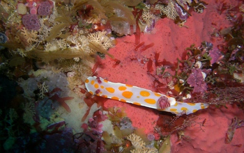
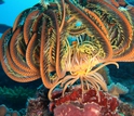
Chemical signals are the primary "language" used by ocean organisms to communicate.
Credit and Larger Version
September 25, 2013
If Dr. Dolittle could talk to the animals, it's more likely he was a chemical ecologist than a linguist, says marine scientist Mark Hay of the Georgia Institute of Technology in Atlanta--at least when it came to talking to the animals (and plants) of the sea.
Chemical signals are the primary "language" used by ocean organisms. Using a kind of extra-sensory perception of the deep, marine animals and plants react to other species and to their environment based on these cues.
Humans are poorly designed to understand such chemically-driven interactions "because we sense the world primarily via visual and auditory input," Hay says.
"In contrast, many ocean species lack eyes and ears. They sense much of their world via chemical signals. In the sea, even species that see and hear rely on chemical cues."
Dark New York City streets--in the sea
Imagine walking along a bustling New York City street at night. Suddenly, the boulevard goes pitch-black and deathly silent--permanently.
How would you find food, a mate or protect yourself against thieves and murderers? What if you had to rely on detecting chemicals produced by other people and other animals to survive?
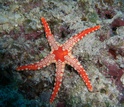
"For ocean animals and plants, it's like that every minute of every day," says Hay. For most marine species, chemical cues determine whether they consume, fight with, run from or mate with the creatures next to them--and whether they are eaten by, infected by or overgrown by natural enemies.
Welcome to New York City...eerily silent and utterly dark...beneath the waves.
Dead ahead are the shapeshifters, marine denizens that use chemical cues to change their outward appearances.
 
Facing the shape-shifters
When the bloom-forming phytoplankton Phaeocystis globosa chemically senses its next-door neighbors under attack by ciliates, which feast on small foods like phytoplankton, it shifts shape and grows in colonies too big for the ciliates to consume.
Then when the phytoplankton's neighbors are attacked by copepods, says Hay, which feed on large foods, Phaeocystis globosa suppresses colony formation and grows as single cells too small to interest the copepods.
"These shifts could alter energy flow, nutrient cycling and patterns of carbon sequestration in the sea," says Hay. "Chemical cues affect not only individual behavior and population-level processes, but also community organization and ecosystem function."
 
Finding food: no clues but molecules
What if you had to fly a plane over an area the size of Canada to locate a grocery store with no cues but a few simple "fresh food" molecules wafting through the air?
Tube-nosed seabirds--storm-petrels, albatrosses, petrels, shearwaters and others--do exactly that. They use a chemical cue to track high-productivity areas in open seas where they forage on zooplankton, fish and squid.
They're responding to the presence of dimethyl sulfide (DMS), produced when zooplankton feed on blooms of phytoplankton then excrete this substance.
"At scales of thousands of square kilometers, DMS may function as an olfactory landscape," says Hay, "indicating ocean areas where phytoplankton and zooplankton accumulate and where the search for prey should be most successful."
 
Chemical cues: from oceans to human health
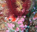
To discover how chemical signals play a part in ocean ecosystems, and perhaps human health, Hay and colleagues are studying marine organisms and how they produce and deploy their chemical arsenals.
Understanding substances that cloak seaweeds and other species could allow scientists to adapt these compounds for use against microbial pathogens, HIV, cancer and other human diseases.
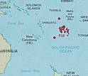
As part of a project supported by the National Science Foundation (NSF), Hay and colleagues have analyzed compounds from more than 800 species in the waters around Fiji Islands like Yanuca. The project is co-funded by the National Institutes of Health's International Cooperative Biodiversity Group program.
"The study of chemical signaling on Fiji Island coral reefs will help us better understand the interactions that keep the oceans healthy," says David Garrison, program director in NSF's Division of Ocean Sciences, which funded the research.
One species has emerged as a frontrunner in Hay's investigations: the red seaweed Callophycus serratus.
The alga is adept at fighting infections. Chemical extracts from Callophycus serratus fend off disease-causing microbes. The compounds are among the largest groups of algal antifungal chemical defenses discovered to date.
"We're in effect ‘listening in' on the fight between this red seaweed and a fungus that's trying to attack it," says Hay. "What we hear may allow us to translate the language of the sea into that of human biomedicine."
 
Tuning into The Deep
He may be tuning in for some time. Callophycus serratus produces at least 28 bioactive compounds.
Why would a single species of seaweed produce so many bioactive substances? The compounds may work together against a host of enemies, says Hay. "Or they may have separate uses we don't yet comprehend."
Hay is busy deciphering. He and colleagues have found that Callophycus serratus contains bromophycolides--in ocean-speak, chemicals that have shown promise as new treatments for infectious diseases.
Whether working along the shores of Fiji or in the seas around Florida, Panama or the Caribbean Islands, Hay is proving that we can interpret the language of marine organisms.
"Knowing what's being communicated will provide a deeper understanding of marine ecosystems," says Hay, "and improve our ability to serve as wise stewards of these natural resources."
-- Cheryl Dybas, NSF (703) 292-7734 
cdybas@nsf.gov
 
Related WebsitesNSF News: Killer Seaweed: Scientists Find First Proof that Chemicals from Seaweeds Damage Coral on Contact: http://www.nsf.gov/news/news_summ.jsp?cntn_id=116813
NSF News: Coral Reef 911: Corals Attacked by Seaweed Use Chemical Signals to Summon Help: http://www.nsf.gov/news/news_summ.jsp?cntn_id=125894
NSF Award: Killer Seaweeds: Allelopathy against Fijian Corals:
 http://www.nsf.gov/awardsearch/showAward?AWD_ID=0929119&HistoricalAwards=false
Photo of a marine animal and plants under water
Using a kind of "ESP," marine animals and plants react to other species based on chemical cues.
Credit and Larger Version
Photo of varios marine organisms in the ocean
Scientists are studying how chemical signals play a part in ocean ecosystems.
Credit and Larger Version
Photo of researchers' base camp  surrounded by banana trees and clothes out to dry in Fiji.
Ecologist Mark Hay and colleagues conduct research on Fiji; its islands are their "base camp."
Credit and Larger Version
Photo of a starfish on a rock under water
Eat, fight with, run from or mate with? For most marine species, the answer lies in biochemistry.
Credit and Larger Version
Map showing Fiji islands next to Australia
Researchers have studied more than 800 species in the waters around Fiji's many islands.
Credit and Larger Version
 
The National Science Foundation (NSF),
Guillermo Gonzalo Sánchez Achutegui

Mi lista de blogs