Mi lista de blogs

jueves, 31 de enero de 2013

COREA DEL SUR SE CONVIERTE EN POTENCIA ESPACIAL CON LANZAMIENTO DE COHETE NARO-1

File:Naro-1.svg
Full resolution(SVG file, nominally 293 × 1,209 pixels, file size: 27 KB). Wikipedia
KSLV (Korean Space Launch Vehicle) también llamada Naro, es una familia de lanzadores orbitales surcoreanos en desarrollo. Inicialmente se pretendía que la tecnología de los KSLV fuese totalmente nacional, pero en 2005 se decidió utilizar como base el cohete Angararuso, que a su vez está todavía en desarrollo. La organización dedicada al desarrollo de los KSLV es el KARI.
Wikipedia.

Centro Espacial NARO


CENTRO ESPACIAL NARO es un puerto espacial de Corea del Sur en la región de Goheung, Jeolla del Sur conducida por el Instituto de Desarrollo Aeroespacial Coreano. (34.431867, 127.535069). Tras la exitosa construcción del Centro Espacial Naro en 2008, Corea del Sur es la 13º Nación que posee su propia lanzadera espacial.1 Construida sobre 4.95 millones de metros cuadrados de tierra recuperada, el Centro Espacial Naro lanzó con éxito al Vehiculo Espacial Coreano el 25 de agosto de 2009.2
El centro espacial se encuentra ubicado aproximadamente a 485 km al sur de Seúl.3 El cual posee, una Plataforma de lanzamiento, una torre de control, angar para el armado y prueba de cohetes, edificios para el ensamblado y control de satélites, Edificio de prensa, una estación de energía eléctrica, un edificio para entrenamiento espacial y una pista de aterrizaje;.4 5
El primer lanzamiento, inicialmente planeado para el 19 de agosto de 2009, fue finalmente realizado el 25 del mismo mes, usando un cohete Ruso-Surcoreano Naro-1, aunque el satélite falló en ingresar a la orbita deseada. Otro lanzamiento similar desde Naro está planificado para mayo del 2010. Los rusos proveerán la tecnología para un tercer lanzamiento en ql caso q el segundo intento también falle.6
WIKIPEDIA


(ACTUALIZACIÓN)- KSLV-1 colocado en plataforma de lanzamiento para despegue

Seúl, 24 de octubre (Yonhap) -- Corea del Sur comenzó este miércoles los preparativos finales para su lanzamiento de un cohete espacial, transportando el cohete a una plataforma de lanzamiento en el Centro Espacial Naro en la costa sur.

  El Vehículo-1 de Lanzamiento Espacial de Corea del Sur (KSLV-1) fue erguido y fijado a la plataforma de lanzamiento después de ser transferido desde un complejo de montaje de ese mismo día, de acuerdo con funcionarios del Instituto de Investigación Aeroespacial de Corea del Sur (KARI, por sus siglas en inglés).

  
"El Naro-1 fue erguido con éxito, utilizando un constructor, a las 5:11 p.m.", dijo el KARI en un comunicado.

  Se dijo que el cohete ha sido conectado correctamente al cable del mástil, que es una estructura que contiene todos los cables eléctricos y las bombas de gas conectados al cohete.

  El cohete espacial, también conocido como Naro-1, está tentativamente programado para ser lanzado el viernes desde el centro espacial, ubicado a 470 kilómetros al suroeste de Seúl. Un ensayo de lanzamiento está previsto para el jueves, junto con las inspecciones técnicas.

  Será el tercer intento de Corea del Sur para enviar el KSLV-1 al espacio después de dos intentos fallidos anteriores en agosto de 2009 y junio de 2010.

   laura@yna.co.kr
Corea del Sur se une al club de potencias espaciales gracias a su cohete Naro.
Seúl, 30 ene (EFE).- Corea del Sur logró hoy lanzar con éxito su cohete Naro, desarrollado parcialmente con tecnología local, lo que tras dos intentos fallidos en 2009 y 2010 le abre por fin las puertas del reducido club de potencias espaciales.
La lanzadera, también conocida como KSLV-1 y portadora del satélite científico STSAT-2C, despegó a las 16.00 hora local (07.00 GMT) desde la base espacial en la isla de Naro, a unos 480 kilómetros al sur de Seúl.
  •  

El cohete Naro-1, el primero fabricado parcialmente con tecnología local, despega hoy desde la plataforma de Goheung, a 480 kilómetros al sur de Seúl, Corea del Sur. EFE


TECNOLOGÍA. Lanzamiento del cohete Naro desde una base espacial surcoreana.

 LANZA CON ÉXITO SU COHETE "NARO"
Corea del Sur llega al club de potencias espaciales
Cumple objetivo de colocar en órbita un satélite científico


Corea del Sur logró ayer lanzar con éxito su cohete Naro, desarrollado parcialmente con tecnología local, lo que tras dos intentos fallidos en 2009 y 2010 le abre por fin las puertas del reducido club de potencias espaciales.
La lanzadera, también conocida como KSLV-1 y portadora del satélite científico STSAT-2C, despegó desde la base espacial en la isla de Naro, a unos 480 kilómetros al sur de Seúl.
El tercer intento en cuatro años se desarrolló sin aparentes problemas, y una hora después los responsables confirmaban que el satélite estaba en la órbita debida y el ministro surcoreano de Ciencia y Tecnología calificaba de éxito la operación.
"El Naro ha sido lanzado con éxito. El satélite fue desplegado 540 segundos después, y un análisis de los datos relacionados muestra que ha entrado correctamente en la órbita estipulada", afirmó el ministro del ramo, Lee Ju-ho.
Se trata de la primera ocasión en que Corea del Sur, cuarta economía de Asia, consigue poner en órbita un satélite desde su territorio, una hazaña que quedó parcialmente ensombrecida por el hecho de que Corea del Norte, su empobrecido vecino comunista, lo logró antes.
El régimen de Pyongyang logró colocar en órbita un satélite con su propio cohete el pasado 12 de diciembre, en una operación duramente condenada por la comunidad internacional, que la consideró una violación de resoluciones de la ONU que le prohíben desarrollar tecnología balística.
Por su parte, la pujante Corea del Sur había enviado al espacio cerca de 10 satélites, pero todos desde plataformas y cohetes foráneos.
En cualquier caso, y aunque sea por detrás de su rival Corea del Norte, el último lanzamiento convierte a Corea del Sur -hogar de algunas de las empresas tecnológicas más potentes del planeta, como Samsung- en el decimotercer país que consigue poner en órbita un satélite con un cohete de fabricación propia.
Esto le permite acortar distancias con otros vecinos asiáticos como Japón, China o la India, que ya cuentan con sus propios programas aeroespaciales.EFE

(AMPLIACIÓN)- Nuevo satélite de Corea del Sur hace contacto con una estación terrestre

Daejeon, Corea del Sur, 31 de enero (Yonhap) -- El nuevo satélite científico de Corea del Sur logró hacer contacto con una estación terrestre, este jueves, en Daejeon, lo que supuso un éxito completo en el lanzamiento del país de su primer cohete espacial el día anterior, dijeron los funcionarios.
El primer contacto de comunicación se llevó a cabo a las 3:27:12 a.m., según los responsables del Centro de Investigación Tecnológica de Satélites del país en el Instituto Avanzado de Ciencia y Tecnología (KAIST, según sus siglas en inglés) en Daejeon, a 160 kilómetros al sur de Seúl.
El contacto se produjo después de que el Vehículo-1 de Lanzamiento Espacial de Corea del Sur (KSLV-1), que transportaba el Satélite-2C de Ciencia y Tecnología, de 100 kilogramos, despegase del Centro Espacial Naro del país a las 4:00 p.m. del miércoles. El centro espacial está a 480 kilómetros al sur de Seúl en Goheung, en la provincia de Jeolla del Sur.
El lanzamiento del miércoles del KSLV-1, también conocido como Naro, fue inicialmente determinado como exitoso, después de que el satélite transmitiera su señal de baliza a una estación terrestre en Noruega, aproximadamente 90 minutos después del despegue.
"A las 4:00 p.m. de hoy, el Naro fue lanzado exitosamente. El satélite fue desplegado 540 segundos después del lanzamiento y un análisis de los datos relacionados muestra que el satélite ha entrado con éxito en la órbita fijada", dijo Lee Ju-ho, ministro de Educación, Ciencia y Tecnología, en una conferencia de prensa celebrada el miércoles por la tarde.
El lanzamiento exitoso del cohete espacial y el despliegue del satélite en su órbita adecuada convierten a Corea del Sur en el 13er. país en haber enviado exitosamente un satélite al espacio desde su propio territorio. Fue el tercer intento del país de enviar el KSLV-1 al espacio; los intentos en 2009 y 2010 terminaron en fracaso.
El país ha enviado, hasta la fecha, 10 satélites al espacio, pero todos ellos fueron lanzados desde territorio extranjero, utilizando cohetes foráneos.
El nuevo satélite, desarrollado autóctonamente por el KAIST, orbita la Tierra cada 103 minutos o alrededor de 14 veces al día.
Sin embargo, tiene una vida operativa corta, de alrededor de un año, ya que fue diseñado en parte para probar la capacidad del país para enviar un satélite al espacio.
El KSLV-1 fue construido parcialmente por el Centro Estatal de Investigación y Producción Espacial Khrunichev de Rusia, pero con su lanzamiento exitoso, Seúl planea desarrollar un vehículo de lanzamiento espacial autóctono.
El país tenía previamente planes para desarrollar su propio cohete espacial, con un empuje de 300 toneladas, para 2021. Sin embargo, el ministro de Ciencia dijo, el miércoles, que el programa de desarrollo podría completarse mucho antes, en 2018 o 2019, con el apoyo gubernamental.

Cronología de los principales acontecimientos que conducen al 3er. lanzamiento de un cohete espacial de Seúl

Centro Espacial Naro, Corea del Sur, 30 de enero (Yonhap) -- La siguiente es una cronología de los principales acontecimientos relacionados con el desarrollo del Vehículo-1 de Lanzamiento Espacial de Corea del Sur, que fue lanzado desde el Centro Espacial Naro del país este miércoles por la tarde.
Marzo de 2001 - Corea del Sur se une al Régimen de Control de Tecnología de Misiles, una asociación internacional informal que supervisa la proliferación de sistemas vectores no tripulados capaces de transportar armas de destrucción masiva.
Agosto de 2002 - Corea del Sur y Rusia confirman los planes para desarrollar el cohete Vehículo-1 de Lanzamiento Espacial de Corea del Sur (KSLV-1, según sus siglas en inglés) y comenzar el diseño y la construcción, con un lanzamiento previsto para el año 2005.
21 de septiembre de 2004 - Corea del Sur y Rusia firman un pacto de cooperación en tecnología espacial.
26 de octubre de 2004 - El Instituto de Investigación Aeroespacial de Corea del Sur (KARI) firma un pacto de cooperación con el Centro Estatal de Investigación y Producción Espacial Khrunichev de Rusia.
2005 - Corea del Sur y Rusia completan el trabajo sobre los diseños críticos para el KSLV-1. La fecha original de lanzamiento, previsto para 2005, se pospone hasta octubre de 2007.
Septiembre de 2006 - Se completa el modelo de ingeniería para la parte superior del cohete.
12 de octubre de 2006 - Seúl dice que la fecha de lanzamiento de octubre de 2007 del KSLV-1 se aplazará un año.
17 de octubre de 2006 - Corea del Sur y Rusia firman un acuerdo de salvaguardia de tecnología.
Julio de 2007 - Se obtiene el diseño crítico para las ​​instalaciones terrestres de apoyo para el lanzamiento.
Septiembre de 2007 - Se completa el modelo de calificación de la parte superior del cohete.
Noviembre de 2007 - Se lleva a cabo por parte de los ingenieros surcoreanos y rusos una revisión crítica del diseño del cohete.
Diciembre de 2007 - Se implementan las revisiones del pacto de cooperación, fijándose una nueva fecha de lanzamiento para finales de 2008.
23 de julio de 2008 - El Gobierno de Corea del Sur dice que el lanzamiento previsto del primer cohete se pospondrá hasta 2009, debido a los retrasos en la llegada del extranjero del cohete propulsor principal y de otras partes clave.
Agosto de 2008 - Rusia construye un vehículo de prueba terrestre (GTV) para el propulsor principal del KSLV-1. Seúl dice que el primer cohete espacial puede ser lanzado en el segundo trimestre de 2009.
12 de marzo de 2009 - El lanzamiento se retrasa hasta finales de julio para dar a los ingenieros más tiempo para revisar los sistemas de seguridad.
10 de mayo de 2009 - Corea del Sur elige "Naro" como el nombre de su primer cohete espacial.
Junio ​​de 2009 - Corea del Sur abre el Centro Espacial Naro. La certificación de la plataforma de lanzamiento se completa usando el KSLV-1 GTV. Una primera fase completa del cohete llega desde Rusia en avión.
17 de julio de 2009 - El lanzamiento se retrasa debido a complicaciones en el análisis de la prueba de encendido del cohete propulsor principal.
30 de julio de 2009 - Rusia realiza con éxito una "prueba de encendido en caliente" en el motor del KSLV-1.
1 de agosto de 2009 - Seúl dice que el KSLV-1 ha sido reprogramado para el lanzamiento el 11 de agosto.
4 de agosto de 2009 - Rusia informa a Seúl que un "problema técnico" relacionado con los datos de la prueba de encendido del motor requerirá más tiempo de comprobación.
7 de agosto de 2009 - El Gobierno dice que el "problema técnico", fue causado por un error de diagnóstico en el procesamiento de los datos, y que el cohete es seguro para el lanzamiento.
11 de agosto de 2009 - Seúl establece una nueva fecha de lanzamiento para el 19 de agosto, después de consultas entre los ingenieros surcoreanos y rusos.
19 de agosto de 2009 - Corea del Sur detiene la cuenta atrás del KSLV-1 cuando faltan menos de ocho minutos para el despegue, después de que el sistema de la secuencia automática de lanzamiento detectase un problema en un tanque de alta presión.
20 de agosto de 2009 - Los ingenieros descubren que un problema de software de poca importancia causó la interrupción de la cuenta atrás y transportan el cohete desde la plataforma de lanzamiento al complejo de ensamblaje para su reparación.
25 de agosto de 2009 - Corea del Sur no logra poner en órbita el satélite.
Septiembre de 2009 - Corea del Sur establece un grupo de trabajo especial para determinar por qué falló su primer cohete espacial.
5 de noviembre de 2009 - Un informe provisional cita un fallo de funcionamiento del ensamblado del carenaje como la razón de que fallase el lanzamiento del cohete.
8 de febrero de 2010 - Un comité independiente confirma que un fallo de funcionamiento del ensamblado del carenaje hizo imposible que el KSLV-1 colocara el satélite científico en la órbita terrestre.
5 de abril de 2010 - El cohete propulsor principal llega al Centro Espacial Naro procedente de Rusia.
19 de abril de 2010 - Corea del Sur anuncia que el 9 de junio intentará lanzar un segundo cohete espacial ensamblado localmente.
7 de junio de 2010 - El KSLV-1 es trasladado a la plataforma de lanzamiento desde el edificio de ensamblaje del cohete y erigido en la plataforma de lanzamiento.
9 de junio de 2010 - El lanzamiento del KSLV-1 se cancela cuando faltan tres horas en el reloj de cuenta atrás, después de que se activasen los extintores de incendios de emergencia.
10 de junio de 2010 - El KSLV-1 explota a los 137,19 segundos después del despegue.
Junio ​​de 2010 - Corea del Sur y Rusia ponen en marcha un Consejo conjunto de Revisión de Fallos.
Julio de 2011 - Corea del Sur y Rusia ponen en marcha un Grupo de Investigación de Fallos.
19 de julio de 2012 - El Comité Espacial Nacional de Corea del Sur aprueba un tercer lanzamiento del KSLV-1.
29 de agosto de 2012 - El cohete propulsor principal del KSLV-1 llega al Aeropuerto Internacional de Gimhae procedente de Rusia.
2 de septiembre de 2012 - El propulsor principal del KSLV-1 llega al Centro Espacial Naro después de su envío, el 29 de agosto, desde Rusia.
11 de septiembre de 2012 - Corea del Sur anuncia que el tercer lanzamiento de su KSLV-1 se llevará a cabo del 26-31 de octubre, designando el 26 de octubre como la fecha candidata principal.
24 de octubre de 2012 - El KSLV-1 es trasladado a la plataforma de lanzamiento desde el edificio de ensamblaje del cohete y erigido en la plataforma de lanzamiento. Se programa el despegue del KSLV-1 desde el Centro Espacial Naro para el 26 de octubre.
26 de octubre de 2012 - El lanzamiento programado del KSLV-1 se retrasa indefinidamente debido a una junta de goma dañada en el conector entre el cohete y su plataforma de lanzamiento.
29 de octubre de 2012 - El Comité de Preparación del Lanzamiento de Corea del Sur designa del 9-24 de noviembre como nuevas fechas candidatas para el tercer lanzamiento del KSLV-1.
14 de noviembre de 2012 - El Comité de Preparación del Lanzamiento anuncia que el tercer lanzamiento se retrasará aún más después de que los ingenieros rusos confirmasen que los daños en la junta de goma en el conector habían sido causados por una pieza defectuosa en el conector, lo que les obligó a reemplazar las partes defectuosas.
22 de noviembre de 2012 - El Comité de Preparación del Lanzamiento anuncia que el tercer lanzamiento del KSLV-1 se llevará a cabo el 29 de noviembre.
29 de noviembre de 2012 - El tercer lanzamiento del KSLV-1 se vuelve a retrasar debido a las "señales anormales" en el sistema de vector de empuje del cohete superior, o la segunda fase, del Naro. El Comité de Preparación del Lanzamiento del país determinó, posteriormente, que las señales anormales fueron causadas por un motor hidráulico defectuoso.
16 de enero de 2013 - El Comité de Preparación del Lanzamiento designa del 30 de enero-8 de febrero como nuevas fechas candidatas para el tercer lanzamiento del KSLV-1.
24 de enero de 2013 - El Comité de Preparación del Lanzamiento anuncia que el tercer lanzamiento del KSLV-1 se llevará a cabo el 30 de enero.
30 de enero de 2013 - El KSLV-1 despega del Centro Espacial Naro de Corea del Sur.
Guillermo Gonzalo Sánchez Achutegui
ayabaca@gmail.com
ayabaca@hotmail.com
ayabaca@yahoo.com
Inscríbete en el Foro del blog y participa : A Vuelo De Un Quinde - El Foro!

nsf.gov - Mutant Gene Responsible for Pigeons' Head Crests

Decoded genome reveals secrets of pigeon traits and origins.-

 English trumpeter rock pigeon with head ornamentation called a shell crest

Head ornamentation called a shell crest is seen on this English trumpeter rock pigeon.
Credit: Michael Shapiro
Download the high-resolution JPG version of the image. (1.5 MB)  An Indian fantail with a head crest called a peak crest.

An Indian fantail--one of 350 rock pigeon breeds--displays a head crest called a peak crest.
Credit: Michael Shapiro
Download the high-resolution JPG version of the image. (1.7 MB) A Jacobin rock pigeon has a head crest known as a hood that hides the bird's face.
A Jacobin rock pigeon has a head crest known as a hood that hides the bird's face.
Credit: Michael Shapiro
Download the high-resolution JPG version of the image. (1 MB)  Rock pigeon with a head crest resembling a mane.

A rock pigeon of the breed old Dutch capuchine has a head crest resembling a mane.
Credit: Michael Shapiro
Download the high-resolution JPG version of the image. (1.2 MB) Feral rock pigeons perched on cliffs near Norfolk in the U.K.

Feral rock pigeons perched on cliffs near Norfolk in the U.K.
Credit: Wikimedia Commons
Download the high-resolution JPG version of the image. (318 KB)  cover of Science magazine

The research team's results are described in the Feb. 1 issue of the journal Science.
Credit: Copyright AAAS 2013
Download the high-resolution JPG version of the image. (1.4 MB)


Scientists have decoded the genetic blueprint of the rock pigeon, unlocking secrets about pigeons' Middle East origins, feral pigeons' kinship with escaped racing birds and how mutations give pigeons traits like feather head crests.
"Birds are a huge part of life on Earth, but we know surprisingly little about their genetics," says Michael Shapiro, one of the study's two principal authors and a biologist at the University of Utah.
In the new study, "we've shown a way forward to find the genetic basis of traits--the molecular mechanisms controlling animal diversity in pigeons," he says. "Using this approach, we expect to be able to do this for other traits in pigeons, and it can be applied to other birds and many other animals as well."
The findings appear in a paper published this week in the online journal Science Express.
Shapiro conducted the research with Jun Wang of China's BGI-Shenzhen (formerly Beijing Genomics Institute) and other scientists from BGI, the University of Utah, Denmark's University of Copenhagen and the University of Texas M.D. Anderson Cancer Center in Houston.
"The research identified the genes contributing to variation in the avian head crest, using the domesticated pigeons that so fascinated and inspired Charles Darwin in developing his theory of natural selection," says George Gilchrist, program director in the National Science Foundation's (NSF) Division of Environmental Biology, which funded the research. "This finding illustrates the power of comparative genomics."
Pigeons were domesticated some 5,000 years ago in the Mediterranean region. Key results of this study include sequencing of the genome of the rock pigeon Columba livia, which is among the most common bird species.
There are some 350 breeds of rock pigeons--all with different sizes, shapes, colors, color patterns, beaks, bone structure, vocalizations and arrangements of feathers on the feet and head--including head crests in shapes known as hoods, manes, shells and peaks.
The pigeon's genetic blueprint is among the few bird genomes sequenced so far, along with those of the chicken, turkey, zebra finch and a common parakeet known as a budgerigar or budgie. "This will give us new insights into bird evolution," Shapiro says.
Using software developed by paper co-author Mark Yandell, a geneticist at the University of Utah, the scientists revealed that a single mutation in a gene named EphB2 causes head and neck feathers to grow upward instead of downward, creating head crests.
"This same gene in humans has been implicated as a contributor to Alzheimer's disease, as well as prostate cancer and possibly other cancers," Shapiro says, noting that more than 80 of the 350 pigeon breeds have head crests, which play a role in attracting mates in many bird species.
The researchers compared the pigeon genome to those of chickens, turkeys and zebra finches. "Despite 100 million years of evolution since these bird species diverged, their genomes are very similar," Shapiro says.

A genome for the birds, a gene for head crests
The biologists assembled 1.1 billion base pairs of DNA in the rock pigeon genome; the researchers believe there are about 1.3 billion total, compared with 3 billion base pairs in the human genome. The rock pigeon's 17,300 genes compare in number with the approximately 21,000 genes in humans.
The researchers first constructed a "reference genome"--a full genetic blueprint--from a male of the pigeon breed named the Danish tumbler.
Shapiro says the study is the first to pinpoint a gene mutation responsible for a pigeon trait, in this case, head crests.
"A head crest is a series of feathers on the back of the head and neck," Shapiro says. "Some are small and pointed. Others look like a shell behind the head; some people think they look like mullets. They can be as extreme as an Elizabethan collar."
The researchers found strong evidence that the EphB2 (Ephrin receptor B2) gene acts as an on-off switch to create a head crest when mutant, and no head crest when normal.
They also showed that the mutation and related changes in nearby DNA are shared by all crested pigeons, so the trait evolved just once and was spread to numerous pigeon breeds by breeders.
Full or partial genetic sequences were analyzed for 69 crested birds from 22 breeds, and 95 uncrested birds from 57 breeds. The biologists found a perfect association between the mutant gene and the presence of head crests.
They also showed that while the head crest trait becomes apparent in juvenile pigeons, the mutant gene affects pigeon embryos by reversing the direction of feather buds--from which feathers later grow--at a molecular level.
Other genetic factors determine what kind of head crest each pigeon develops: shell, peak, mane or hood.
Tracking the origins of pigeons
A 2012 study by Shapiro provided limited evidence of pigeons' origins in the Middle East and some breeds' origins in India and indicated kinship between common feral or free-living, city pigeons and escaped racing pigeons.
In the new study, "we included some different breeds that we didn't include in the last analysis," Shapiro says. "Some of those breeds only left the Middle East in the last few decades. They've probably been there for hundreds if not thousands of years. If we find that other breeds are closely related to them, then we can infer those other breeds probably also came from the Middle East."
The scientists found that the owl breeds--pigeon breeds with very short beaks that are popular with breeders--likely came from the Middle East. They're closely related to breeds from Syria, Lebanon and Egypt.
The research also uncovered a shared genetic heritage between breeds from Iran and breeds likely from India, consistent with historical records of trade routes between those regions. People were not only sharing goods along those routes, but probably also interbreeding their pigeons.
As for the idea that free-living pigeons descended from escaped racing pigeons, Shapiro says his 2012 study was based on "relatively few genetic markers scattered throughout the genome. We now have stronger evidence based on 1.5 million markers, confirming the previous result with much better data."
The scientists analyzed partial genomes of two feral pigeons: one from a U.S. Interstate-15 overpass in Utah's Salt Lake Valley, the other from Lake Anna in Virginia.
"Despite being separated by 1,000 miles, they are genetically very similar to each other and to the racing homer breed," Shapiro says.
"Darwin used this striking example to communicate how natural selection works," he says. "Now we can get to the DNA-level changes that are responsible for some of the diversity that intrigued Darwin 150 years ago."
The study's co-authors from the University of Utah include Yandell, Eric Domyan, Zev Kronenberg, Michael Campbell, Anna Vickery and Sydney Stringham; Chad Huff is a co-author from the University of Texas.
The study was also funded by the Burroughs Wellcome Fund, the University of Utah Research Foundation, the National Institutes of Health and the Danish National Research Foundation.
-NSF-
Media Contacts Cheryl Dybas, NSF (703) 292-7734 cdybas@nsf.gov
Lee Siegel, University of Utah (801) 581-8993 lee.siegel@utah.edu
The National Science Foundation (NSF) is an independent federal agency that supports fundamental research and education across all fields of science and engineering. In fiscal year (FY) 2012, its budget is $7.0 billion. NSF funds reach all 50 states through grants to nearly 2,000 colleges, universities and other institutions. Each year, NSF receives over 50,000 competitive requests for funding, and makes about 11,000 new funding awards. NSF also awards nearly $420 million in professional and service contracts yearly.
Useful NSF Web Sites:
NSF Home Page: http://www.nsf.gov
NSF News: http://www.nsf.gov/news/
For the News Media: http://www.nsf.gov/news/newsroom.jsp
Science and Engineering Statistics: http://www.nsf.gov/statistics/
Awards Searches: http://www.nsf.gov/awardsearch/
The National Science Foundation (NSF).
 Guillermo Gonzalo Sánchez Achutegui
ayabaca@gmail.com
ayabaca@hotmail.com
ayabaca@yahoo.com
Inscríbete en el Foro del blog y participa : A Vuelo De Un Quinde - El Foro!

NASA - NASA Launches Next-Generation Communications Satellite

TDRS-K Heads for Space Aboard Atlas V

 http://www.nasa.gov/images/content/723618main_tdrsk_launch720.jpg
Image above: The Atlas V rocket with the TDRS-K spacecraft aboard at the launch pad at Cape Canaveral Air Force Station in Florida. Photo credit: NASA
› Larger image


The Tracking and Data Relay Satellite project, known as TDRS, provides follow-on and replacement spacecraft necessary to maintain and expand the NASA Space Network. TDRS-K, as the newest satellite is called, launched Jan. 30. TDRS-K is the first of three next-generation satellites designed to ensure vital operational continuity for NASA by expanding the lifespan of the fleet. Each of the new satellites has a higher performance solar panel design to provide more spacecraft power. This upgrade will return signal processing for the S-Band multiple access service to the ground -- the same as the first-generation TDRS spacecraft. Ground-based processing allows TDRS to service more customers with different and evolving communication requirements.

Media Resources
› Launch Events Coverage
› NASA TV
 
 NASA Launches Next-Generation Communications Satellite
 
 
CAPE CANAVERAL, Fla. -- The first of NASA's three next-generation Tracking and Data Relay Satellites (TDRS), known as TDRS-K, launched at 8:48 p.m. EST Wednesday from Cape Canaveral Air Force Station in Florida.

"TDRS-K bolsters our network of satellites that provides essential communications to support space exploration," said Badri Younes, deputy associate administrator for Space Communications and Navigation at NASA Headquarters in Washington. "It will improve the overall health and longevity of our system."

The TDRS system provides tracking, telemetry, command and high-bandwidth data return services for numerous science and human exploration missions orbiting Earth. These include the International Space Station and NASA's Hubble Space Telescope.

"With this launch, NASA has begun the replenishment of our aging space network," said Jeffrey Gramling, TDRS project manager. "This addition to our current fleet of seven will provide even greater capabilities to a network that has become key to enabling many of NASA's scientific discoveries."

TDRS-K was lifted into orbit aboard a United Launch Alliance Atlas V rocket from Space Launch Complex-41. After a three-month test phase, NASA will accept the spacecraft for additional evaluation before putting the satellite into service.

The TDRS-K spacecraft includes several modifications from older satellites in the TDRS system, including redesigned telecommunications payload electronics and a high-performance solar panel designed for more spacecraft power to meet growing S-band requirements. Another significant design change, the return to ground-based processing of data, will allow the system to service more customers with evolving communication requirements.

The next TDRS spacecraft, TDRS-L, is scheduled for launch in 2014. TDRS-M's manufacturing process will be completed in 2015.

NASA's Space Communications and Navigation Program, part of the Human Exploration and Operations Mission Directorate at the agency's Headquarters in Washington, is responsible for the space network. The TDRS Project Office at NASA's Goddard Space Flight Center in Greenbelt, Md., manages the TDRS development program. Launch services were provided by United Launch Alliance. NASA's Launch Services Program at the Kennedy Space Center was responsible for acquisition of launch services.

For more information about TDRS, visit:
 NASA
Guillermo Gonzalo Sánchez Achutegui
ayabaca@gmail.com
ayabaca@hotmail.com
ayabaca@yahoo.com  
Inscríbete en el Foro del blog y participa : A Vuelo De Un Quinde - El Foro!

NASA - Tracking and Data Relay Satellite Launched


 http://www.nasa.gov/images/content/723698main_2013-1271_946-710.jpg

Download Image

› Full Size

Tracking and Data Relay Satellite Launches

A United Launch Alliance Atlas V 401 rocket streaks away from Space Launch Complex 41 into the night sky over Cape Canaveral Air Force Station in Florida, carrying NASA's Tracking and Data Relay  Satellite-K, TDRS-K, to orbit.

The TDRS-K spacecraft is part of the next-generation series in the Tracking and Data Relay Satellite System, a constellation of space-based communication satellites providing tracking, telemetry, command and high-bandwidth data return services.
 Photo credit: NASA/Glenn Benson
NASA
Guillermo Gonzalo Sánchez Achutegui
ayabaca@gmail.com
ayabaca@hotmail.com
ayabaca@yahoo.com
Inscríbete en el Foro del blog y participa : A Vuelo De Un Quinde - El Foro!

miércoles, 30 de enero de 2013

NASA - Herschel Finds Star Possibly Making Planets Past Its Prime


 Artist's illustration shows a planetary disk (left) that weighs the equivalent of 50 Jupiter-mass planets
 This artist's illustration shows a planetary disk (left) that weighs the equivalent of 50 Jupiter-mass planets. Image credit: NASA/JPL-Caltech › Full image and caption

Download Image

› Full Size
 Artist's concept illustrates an icy planet-forming disk around a young star called TW Hydrae
This artist's concept illustrates the planet-forming disk around TW Hydrae, located about 175 light-years away in the Hydra, or Sea Serpent, constellation. Image credit: NASA/JPL-Caltech
› Full image and caption

Download Image

› Full Size


 PASADENA, Calif. -- A star thought to have passed the age at which it can form planets may, in fact, be creating new worlds. The disk of material surrounding the surprising star called TW Hydrae may be massive enough to make even more planets than we have in our own solar system.
The findings were made using the European Space Agency's Herschel Space Telescope, a mission in which NASA is a participant.
At roughly 10 million years old and 176 light years away, TW Hydrae is relatively close to Earth by astronomical standards. Its planet-forming disk has been well studied. TW Hydrae is relatively young but, in theory, it is past the age at which giant plants already may have formed.
"We didn't expect to see so much gas around this star," said Edwin Bergin of the University of Michigan in Ann Arbor. Bergin led the new study appearing in the journal Nature. "Typically stars of this age have cleared out their surrounding material, but this star still has enough mass to make the equivalent of 50 Jupiters," Bergin said.
In addition to revealing the peculiar state of the star, the findings also demonstrate a new, more precise method for weighing planet-forming disks. Previous techniques for assessing the mass were indirect and uncertain. The new method can directly probe the gas that typically goes into making planets.
Planets are born out of material swirling around young stars, and the mass of this material is a key factor controlling their formation. Astronomers did not know before the new study whether the disk around TW Hydrae contained enough material to form new planets similar to our own.
"Before, we had to use a proxy to guess the gas quantity in the planet-forming disks," said Paul Goldsmith, the NASA project scientist for Herschel at NASA's Jet Propulsion Laboratory in Pasadena, Calif. "This is another example of Herschel's versatility and sensitivity yielding important new results about star and planet formation."
Using Herschel, scientists were able to take a fresh look at the disk with the space telescope to analyze light coming from TW Hydrae and pick out the spectral signature of a gas called hydrogen deuteride. Simple hydrogen molecules are the main gas component of planets, but they emit light at wavelengths too short to be detected by Herschel. Gas molecules containing deuterium, a heavier version of hydrogen, emit light at longer, far-infrared wavelengths that Herschel is equipped to see. This enabled astronomers to measure the levels of hydrogen deuteride and obtain the weight of the disk with the highest precision yet.
"Knowing the mass of a planet-forming disk is crucial to understanding how and when planets take shape around other stars," said Glenn Wahlgren, Herschel program scientist at NASA Headquarters in Washington.
Whether TW Hydrae's large disk will lead to an exotic planetary system with larger and more numerous planets than ours remains to be seen, but the new information helps define the range of possible planet scenarios.
"The new results are another important step in understanding the diversity of planetary systems in our universe," said Bergin. "We are now observing systems with massive Jupiters, super-Earths, and many Neptune-like worlds. By weighing systems at their birth, we gain insight into how our own solar system formed with just one of many possible planetary configurations."
Herschel is a European Space Agency (ESA) cornerstone mission, with science instruments provided by a consortium of European institutes and with important participation by NASA. NASA's Herschel Project Office is based at JPL, which contributed mission-enabling technology for two of Herschel's three science instruments. NASA's Herschel Science Center, part of the Infrared Processing and Analysis Center at the California Institute of Technology (Caltech) in Pasadena, supports the United States astronomical community. Caltech manages JPL for NASA.
More information is online at 
and
 
 
Whitney Clavin 818-354-4673
Jet Propulsion Laboratory, Pasadena, Calif.
whitney.clavin@jpl.nasa.gov

J.D. Harrington 202-358-5241
Headquarters, Washington
j.d.harrington@nasa.gov

NASA
Guillermo Gonzalo Sánchez Achutegui
ayabaca@gmail.com
ayabaca@hotmail.com
ayabaca@yahoo.com
Inscríbete en el Foro del blog y participa : A Vuelo De Un Quinde - El Foro

NASA - NASA, Newseum Present Media Preview Of PBS' Earth From Space

Global Weather Machine

  • By Mark Hoover
  • Posted 10.13.98
  • NOVA
We live in an ocean of air, seething and flowing around us, changing-sometimes violently-every day. In the heart of this swirling machinery of rain clouds and jetstreams, hot desert winds and frozen arctic storms, there is one constant: change. A trillion and a half days have passed since the Earth was born in a spinning disk of stardust, and no two of those days have ever had the same weather.
This NASA image of wind patterns over the Pacific Ocean gives a sense of the dynamism of global weather. Enlarge Photo credit: NASA

what is weather?

Driven by the heat of the sun, weather is an interlocking system of cycles. Water evaporates, rises, cools, and falls as rain, only to evaporate once again. The sun rises and sets every day, with the air warming and cooling in response, and the cycle endlessly repeating. Low pressure systems suck high pressure systems into their vacuum, creating spinning masses of wind and clouds bigger than Texas; these cyclones are swept across the skies by persistent high-speed winds miles up in the atmosphere, rivers of air in a relentless race around the globe. Weather, in all its cycles and clashes, arises from a simple fact: the sun heats some parts of the Earth more than others.
Because the Earth is a globe, and not a flat board, the sun shines almost straight down on the tropics, baking them every day of the year. But at the poles, the angle is small and the sun's rays are weak, and the poles are therefore cold. Nature "abhors" this imbalance, and tries to fix it. As quickly as solar heat flows in to the tropics, it begins flowing out toward the poles, seeking to equalize the difference. The unrelenting march of this energy-on-the-move, from high concentration to low concentration, is the piston in the engine that propels weather.
When warm air leaves the tropics and heads toward the poles, cold air from near the poles is sucked back toward the tropics. This exchange sets up two-lane highways for air rushing to and from the tropics. These highways of air are called convection cells, and they are the reason wind blows.
The major surface wind bands of Earth. Each hemisphere is divided into three belts. The path of a storm greatly depends upon the wind belt in which it is located. The easterly (west-blowing) trade winds of both hemispheres collide near the equator, in a region called the Intertropical Convergence Zone (ICTZ). Enlarge Photo credit: University of Illinois WW2010 Project
Air flowing back and forth in these great cells is pushed sideways by the Earth's rotation, dragged by friction with the land and the sea, and squeezed by gravity. All of these distortions cause turbulent mixing of the winds, and soon lead to the organization of storm centers due to unevenness between warm and cold. In particular, the sideways push given the winds by the spinning of the planet-called the Coriolis Effect-causes the constant convective flows to organize in bands, where the flow direction varies according to latitude. These bands are responsible for prevailing winds on the surface, and jetstreams high in the atmosphere.
The ITCZ on this satellite image is the band of bright clouds located just north of the equator. This zone is a prolific contributor of storms and clouds to the world's weather. Enlarge Photo credit: NASA
We can see these bands of wind clearly in Jupiter's atmosphere, because Jupiter rotates at a furious pace, once every ten hours. We can also see them clearly on Earth when we take a picture from far out in space.
As on Earth, Jupiter shows distinct wind bands generated by convection and rotation forces. Scientists have measured wind speeds in Jupiter's "Little Red Spot" reaching up to about 384 miles per hour—twice as fast as the winds of a Category 5 hurricane. Enlarge Photo credit: NASA

El Niño'S POWER

El Niño exploits this organization of winds into bands when it causes major weather changes around the world. Specifically, El Niño can affect the path of flow in these bands, and the cyclones that are ushered across the surface by them are now delivered to different areas than normal. Think of the wind bands—both at the surface and high in the sky—as a tram, a streetcar on which storm systems hitch a ride as they travel around the Earth. El Niño moves the tracks—the stormtracks—of this tram. The answer to the puzzle of how this happens is literally blowing in the wind.
How does El Niño take over such a huge system? It begins with an effect due to the vastness of the Pacific Ocean itself, an effect intimately related to the birth of an El Niño. In the Pacific near the equator, the prevailing winds blow from east to west, as cool air sinking from higher latitudes toward the equator gets whipped sideways by the Coriolis force. We know these as the tradewinds, which sailors of old could always depend upon to blow steadily in the same direction.
In the tropical Pacific, these west-blowing tradewinds push steadily against the sea for thousands of miles. The warm water on the surface is literally blown sideways, and the water piles up in the west, creating a pool thousands of miles across. This leads to a heat imbalance: as more and more warm water is stripped from the east and moved west, cold waters from deep in the ocean near South America are drawn up to take its place. This cool water inhibits evaporation and the creation of rain clouds in east, which is why the Galapagos Islands and the coast of Peru are usually deserts.
The El Niño temperature anomaly of 1997-98 (appearing here as a red band in the Pacific Ocean) affected weather worldwide. Enlarge Photo credit: NASA / Image by R.B. Husar, Washington University; the land layer from the SeaWiFS Project; fire maps from the European Space Agency; the sea surface temperature from the Naval Oceanographic Office's
Just the opposite effect happens in the west, near Australia: intense rain cloud formation occurs as warm moist air, heated by the warm sea, rises and condenses into clouds. These clouds carry the drenching rains of the monsoons upon which the entire region of Indonesia and Southeast Asia depends. The huge volumes of rising warm air create a vacuum as they move upward, which draws cooler air from the east to replace it, strengthening the tradewinds and reinforcing the entire cycle. Another two-lane convection highway is created, but instead of between the equator and the poles, this one is between coastal South America and the region of Australia.
Here's where it gets interesting, the crux of the mystery of El Niño. This cycle should be self-perpetuating. But it's not. For unknown reasons, every few years, something hidden in the machinery causes the west-blowing tradewinds to slacken in the Pacific. The warm waters, which have been held by the winds in a pile 5 feet above sea level in the west, begin to flow back across the sea, drawn down by gravity, like a river breaching a levee. This massive surge of heated water shoots across the ocean and repositions itself near South America. East becomes west. Because of the heated water, all of the rainmaking that normally would happen in the west now happens in the east, and the convection cell reverses flow, which means rising warm air in the east sucks in the air from the west, and the tradewinds actually reverse their direction. Because the water in the west is now comparatively cool, rainmaking stops. The monsoons fail in Indonesia, but unending rains begin in Peru. The Child has arrived.
In its new, temporary headquarters off South America, the warm pool's heat again creates a huge mass of warm moist air, which bulges into the zones of prevailing winds at the surface as well as high in the air. Like a car dumped in a stream, this foreign obstruction creates ripples and waves "downstream" in the vast air rivers that circulate the Earth. These ripples cascade outward, pushing and disturbing the midlatitude jetstreams which sweep weather across the temperate zones. Off the west coast of North America, the bulging effect is pronounced. Pacific storms which normally would remain in the tropics now have an open door to the west coast, as the jet stream lurches north. California, Mexico, and even British Columbia brace for an onslaught of winter rain.
When a very strong El Niño strikes surface waters in the equatorial Pacific Ocean, warm water anomalies (red) develop in the Central Pacific. Winds that normally blow in a westerly direction weaken, allowing the easterly winds to push the warm water up against the South American coast. Enlarge Photo credit: NASA
After lurching north, the jet stream (like everything else in the system) tries to compensate for its too-far north motion by diving south, usually over the Rocky Mountains. It then snakes north again, creating the classic El Niño pattern. Because the jet stream represents a boundary between cold northern air and warm moist southern air, meteorologists are able to make general predictions for weather in an El Niño winter.
For starters, Pacific storms form farther east than usual. The northward bulge of the jet stream then conducts these abnormal storms into California and Mexico. Meanwhile, normal winter storms that would otherwise be steered through Washington and Oregon now veer northward toward the coast of Alaska, eventually being guided east into Canada. The west coast gets drenched; the Canadian Rockies get record snowfalls.
By strengthening east-blowing winds in the Caribbean, El Niño also creates a favorable environment for storms to develop in the Gulf of Mexico, and the displaced jetstream lets these storms pass up into the southeast of the United States. Florida and the southeastern states have a cool, abnormally rainy winter. A similar strengthening of the east-blowing winds in the Southern Hemisphere during its winter season brings massive storms to southern Brazil, Chile and Argentina.
In the midwest and northeast, the jetstream's strange dip and rise keeps colder Canadian air stuck in Canada, far north of its usual winter position. Acting as a boundary between this cold northern air and mild southern air, the displaced jetstream lets Chicago and New York enjoy a relatively warm, if somewhat wet, winter.
Because the rain machine in the west stops working, southeast Asia and Australia suffer devastating droughts. Meanwhile, North and South America get drenched, because the rain machine in the east is working overtime. Farther downstream in the great wind bands that circle the globe, El Niño continues to create havoc. By using the bands of prevailing winds as avenues along which to transmit its disruptive waves, El Niño eventually influences weather in Africa, the North Atlantic, even the Middle East. Teleconnected to distant regions by the Earth's rivers of air, El Niño invades the global weather machine.
This feature originally appeared on the site for the NOVA program Tracking El Nino.

NASA, Newseum Present Media Preview Of PBS' Earth From Space
 
 
WASHINGTON -- NASA and the Newseum will host a preview for news media of the upcoming NOVA special, "Earth from Space," at noon EST Monday, Feb. 4, at the Newseum, 555 Pennsylvania Ave. NW in Washington.

"Earth from Space" is scheduled to air nationwide at 9 p.m. EST Feb. 13 on Public Broadcasting Service television stations. The two-hour special explores how satellites are transforming our view of Earth and features interviews with scientists and new visualizations of our complex planet. The centerpiece of the program is an animation of the globe composed of 23 layers of satellite-based data and more than 125,000 images from space.

A question-and-answer session with scientists appearing in "Earth from Space" will follow the screening of the 20-minute preview. The panelists are:

-- Paula Apsell, senior executive producer, NOVA, and director of the WBGH science unit, Boston
-- Piers Sellers, deputy director, Sciences and Exploration Directorate, Goddard Space Flight Center, Greenbelt, Md.
-- Waleed Abdalati, director, Earth Science and Observation Center, University of Colorado, Boulder
-- Jeff Halverson, associate professor, University of Maryland, Baltimore County

To attend, news media representatives must register in advance no later than Friday, Feb. 1, with Steve Cole by telephone at 202-358-0918 or by email at stephen.e.cole@nasa.gov.

NOVA is produced by WGBH. For more information on "Earth from Space," visit:
 NASA
Guillermo Gonzalo Sánchez Achutegui
ayabaca@gmail.com
ayabaca@hotmail.com
ayabaca@yahoo.com
Inscríbete en el Foro del blog y participa : A Vuelo De Un Quinde - El Foro!

NASA - Chandra Puts Stellar Effervescence on Display

Superbubble DEM L50

 Composite image of superbubble DEM L50
 This composite image shows the superbubble DEM L50 (a.k.a. N186) located in the Large Magellanic Cloud about 160,000 light years from Earth. Superbubbles are found in regions where massive stars have formed in the last few million years. The massive stars produce intense radiation, expel matter at high speeds, and race through their evolution to explode as supernovas. The winds and supernova shock waves carve out huge cavities called superbubbles in the surrounding gas.

X-rays from NASA's Chandra X-ray Observatory are shown in pink and optical data from the Magellanic Cloud Emission Line Survey (MCELS) are colored in red, green and blue. The MCELS data were obtained with the University of Michigan's 0.9-meter Curtis Schmidt telescope at Cerro Tololo Inter-American Observatory (CTIO). The shape of DEM L50 is approximately an ellipse, with a supernova remnant named SNR N186 D located on its northern edge.

Like another superbubble in the LMC, N44, DEM L50 gives off about 20 times more X-rays than expected from standard models for the evolution of superbubbles. A Chandra study published in 2011 showed that there are two extra sources of the bright X-ray emission: supernova shock waves striking the walls of the cavities, and hot material evaporating from the cavity walls.

The Chandra study of DEM L50 was published in the Astrophysical Journal in 2011 and was led by Anne Jaskot from the University of Michigan in Ann Arbor. The Chandra study of DEM L50 was led by Anne Jaskot from the University of Michigan in Ann Arbor. The co-authors were Dave Strickland from Johns Hopkins University in Baltimore, MD, Sally Oey from University of Michigan, You-Hua Chu from University of Illinois and Guillermo Garcia-Segura from Instituto de Astronomia-UNAM in Ensenada, Mexico.

NASA's Marshall Space Flight Center in Huntsville, Ala., manages the Chandra program for NASA's Science Mission Directorate in Washington. The Smithsonian Astrophysical Observatory controls Chandra's science and flight operations from Cambridge, Mass.

Credits: X-ray: NASA/CXC/Univ of Michigan/A.E.Jaskot, Optical: NOAO/CTIO/MCELS

› Read more/access all images
› Chandra's Flickr photoset


J.D. Harrington, 202-358-0321
Headquarters, Washington
j.d.harrington@nasa.gov

Janet Anderson, 256-544-0034
Marshall Space Flight Center, Huntsville, Ala.
janet.l.anderson@nasa.gov

Megan Watzke 617-496-7998
Chandra X-ray Center, Cambridge, Mass.
mwatzke@cfa.harvard.edu 
NASA
Guillermo Gonzalo Sánchez Achutegui
ayabaca@gmail.com
ayabaca@hotmail.com
ayabaca@yahoo.com
Inscríbete en el Foro del blog y participa : A Vuelo De Un Quinde - El Foro!

martes, 29 de enero de 2013

NASA - Andromeda's Colorful Rings


 Andromeda galaxy

Download Image

› Full Size 
NASA
Guillermo Gonzalo Sánchez Achutegui
ayabaca@gmail.com
ayabaca@hotmail.com
ayabaca@yahoo.com 

lunes, 28 de enero de 2013

nasa - Remembering the Challenger Crew


 http://upload.wikimedia.org/wikipedia/commons/4/44/Space_Shuttle_Challenger_%2804-04-1983%29.JPEG
Full resolution(2,996 × 2,400 pixels, file size: 1.36 MB, MIME type: image/jpeg)
WIKIPEDIA. 
http://upload.wikimedia.org/wikipedia/commons/9/9f/Challenger_explosion.jpgThe Challenger Explosion
Full resolution(3,555 × 2,879 pixels, file size: 1.3 MB, MIME type: image/jpeg)
Space Shuttle Challenger's smoke plume after its in-flight breakup, resulting in its crash and the deaths of all seven crew members. WIKIPEDIA
 Left to right are Teacher-in-Space payload specialist Sharon Christa McAuliffe; payload specialist Gregory Jarvis; and astronauts Judith A. Resnik, mission specialist; Francis R. (Dick) 
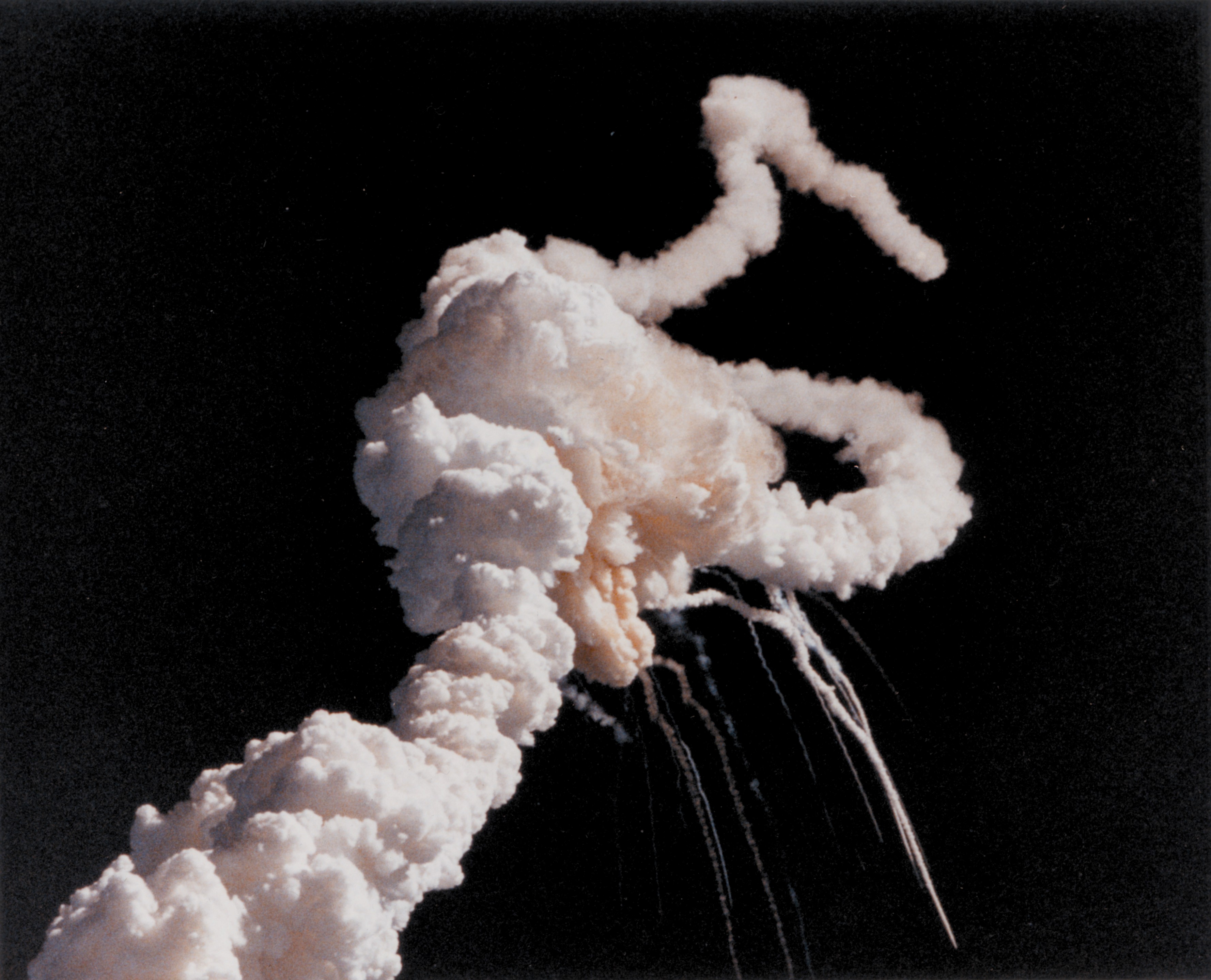
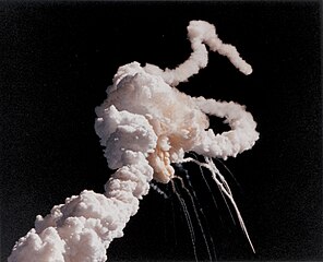
Scobee, mission commander; Ronald E. McNair, mission specialist; Mike J. Smith, pilot; and Ellison S. Onizuka, mi

Download Image

› Full Size
NASA
Guillermo Gonzalo Sánchez Achutegui
ayabaca@gmail.com
ayabaca@hotmail.com
ayabaca@yahoo.com
 

domingo, 27 de enero de 2013

CAMBIO CLIMÁTICO: Todos los países quieren sentarse en la mesa donde se decidida sobre el Ártico

 
Uno de los aspectos que más me gusta de la NASA es que además de dedicarse a la investigación científica y a la exploración espacial, también dedican esfuerzos a la divulgación y a satisfacer la curiosidad de la ciudadanía. Visitar su web, además de acceder a la información institucional, supone abrir una puerta a vídeos y fotografías sorprendentes del espacio o de la Tierra con las que podemos observar lugares como el Cráter Ouarkziz o los surcos que dejó el rover del Apolo 15 en la Luna. Gracias a las imágenes de alta resolución de los satélites de la NASA además de mostrar al gran público detalles sobre la Tierra, los científicos pueden estudiar efectos de la propia actividad humana como el cambio climático y cómo afecta éste, por ejemplo, a las grandes masas de hielo de los polos, algo que ahora podemos ver gracias a una espectacular imagen en alta resolución del Ártico que la NASA acaba de publicar.
La imagen publicada por la NASA es el resultado de 15 órbitas del satélite utilizado en la misión Suomi NPP (Suomi National Polar-orbiting Partnership), un satélite orientado al estudio del cambio climático que fue lanzado el 28 de octubre de 2011 desde la base de la Fuerza Aérea de Estados Unidos de Vandenberg (California), dentro de un programa para el lanzamiento de una nueva generación satélites para observar la Tierra. El satélite, que debe su nombre al meteorólogo Verner E. Suomi (considerado padre de la meteorología actual basada en la información procedente de los satélites), realiza unas catorce pasadas diarias alrededor de la Tierra con el objetivo de explorar la superficie de nuestro planeta y ofrecer imágenes de alta resolución a los científicos que estudian los efectos del cambio climático en la vegetación, el agua o la atmósfera en un proyecyo coordinado de la NASA junto a la Administración Nacional de Océanos y Atmósfera y el Departamento de Defensa de Estados Unidos.
En esta ocasión, la imagen publicada por la NASA se centra en el Ártico, Europa y Asia y, a pesar de las nubes, podemos ver claramente la masa de hielo del casquete polar (en la zona superior de la imagen) y de izquierda a derecha Europa (comenzando por la península Ibérica) y Asia (y en la zona inferior de la imagen el norte de África y la Península Arábiga. La foto, como es lógico, procede de la combinación y superposición de distintas imágenes captadas durante las distintas pasadas del satélite y, realmente, el resultado es impresionante.
La verdad es que vale la pena pasarse por la galería que la NASA mantiene en Flickr para ver algunas de las impresionantes imágenes de la Tierra que ha ido captando este satélite.
Imágenes: NASA
 ALTIOYO.

Increibles Imágenes del Ártico

FRIKI.net


Tromso (Noruega), 25 ene (EFE).- El Ártico se resquebraja a velocidad de vértigo con posibilidades de provocar graves alteraciones, pero los países han optado por desoír a los científicos e iniciar una lucha diplomática por sentarse en la mesa donde se decida qué pasará con los recursos que ocultaba el hielo.

La Comisaria Europea de Pesca, Maria Damanaki, charla con el ministro sueco de Exteriores y actual presidente del Consejo Artico, Carl Bildt en el Congreso Arctic Frontiers, en Tromso, Noruega. A su derecha, el ministro de Exteriores noruego, Espen Barth Eide y la ministra de Sanidad canadiense y próxima presidenta del Consejo Artico, Leona Aglukkaq. EFE/Caty Arevalo


Los países han dejado constancia de su desesperación por no quedar fuera del reparto de "la tarta" ártica en el plenario, pasillos y hasta en los baños del Congreso Internacional sobre el Artico, Arctic Frontiers, que se celebra esta semana en la ciudad noruega de Tromso.
Esta es la octava ocasión que Noruega organiza un cónclave en la "capital del Ártico", pero nunca había reunido a tal cantidad de delegados (más de 1.000) y altos representantes políticos (ocho ministros y más de veinte embajadores).
Durante el periodo que separa el primer Arctic Frontiers de 2006, con el que un grupo de investigadores de la Universidad de Tromso trataron de promover un encuentro para alertar a los políticos de lo que estaba pasando en el Ártico, y éste de 2013, este océano ha perdido durante el verano una superficie helada casi dos veces del tamaño de España. 
EL CLUB MAS DESEADO
En este tiempo se ha sabido que la retirada del hielo, que podría ser total en verano en 2030, haría accesibles el 30 % de las reservas de gas mundiales sin explotar y el 15 % de las de petróleo, importantes caladeros pesqueros y golosas rutas de navegación, según datos del propio Consejo Ártico (CA), que ha pasado de ser un órgano intergubernamental anodino a un foro donde todos quieren estar.
El CA nació en 1996, paradójicamente, para promover el desarrollo sostenible y la cooperación en este océano, gran parte del cual es territorio internacional administrado por las Naciones Unidas.
Tiene como miembros a los ocho países con territorios por encima del Circulo Polar -Canadá, Rusia, Noruega, Dinamarca, Islandia, Estados Unidos, Suecia y Finlandia- y a sus comunidades indígenas, y cuenta con más de una veintena de observadores.
Seis de ellos poseen el rango de "permanentes", como es el caso de España, y tienen derecho a participar en sus seis grupos de trabajo y acudir a las reuniones, aunque no a votar ni a decidir, explica el recién nombrado secretario del CA, el islandés Magnus Johannesson.

TENSIONES DENTRO Y FUERA
En principio, las competencias del CA, con sede en Tromso, no van más allá de las citadas, pero el hecho de que sea el foro de mayor nivel político para tratar las cuestiones de una región en la que los países solo parecen ven oportunidades económicas ha desencadenado importantes tensiones dentro y fuera del mismo.
En su seno, Canadá o Rusia parecen preferir "un Ártico a cinco" en el que solo estén los cinco Estados limítrofes (ellos dos más EEUU, Noruega y Dinamarca), sin las comunidades indígenas, y se niegan a aceptar más observadores, según confirman a Efe fuentes diplomáticas de ambos países.
En contraposición, ministros de países sin fronteras directas, como el titular de Industria de Islandia, Steingrimur Sigfusson, o el de Exteriores de Suecia, Carl Bildt, han sostenido en sus discursos que el CA debe ser el foro a ocho donde se decida todo lo que concierne al Ártico.
Johannesson confirma que el CA tiene sobre la mesa 14 solicitudes para ser observadores, entre ellas las de China, Japón, Corea del Sur, Italia, Singapur o la Unión Europea, cuyos mandatarios han acudido a Arctic Frontiers a dar argumentos para ser aceptados en este deseado club.
Tras el embajador chino en Noruega, Zhao Jun, quien ha llegado a decir que China "se siente un Estado ártico", la más insistente ha sido la comisaría europea de Pesca, Maria Damanaki

REUNION DECISIVA EN MAYO
La UE, que ya ha sido rechazada en dos ocasiones (2009 y 2011), y los otros trece candidatos tendrán en mayo la que probablemente sea su ultima oportunidad para entrar en varios años, ya que la presidencia dejará de estar en los países nórdicos europeos, partidarios de nuevos observadores, y pasará a Canadá y luego a EEUU.
La más de una decena de representantes indígenas que han hablado en el Plenario de Arctic Frontiers han reclamado, por su parte, que quieren ser consultados y tener derecho a decidir sobre todo lo que ocurra en el Ártico, pues serán "los primeros afectados", subraya Sara Olsvig, representante de los Innuit de Groenlandia en el Parlamento danés.
La ministra de Sanidad canadiense, de origen indígena y próxima presidenta del CA, Leona Aglukkaq, subraya que el primer objetivo de su etapa al frente del Consejo será que estas poblaciones se beneficien "del boom económico que experimentará el Ártico en los próximos años". EFE