DiscoveryNative Americans Trained to Address Environmental Problems on Their Lands
NSF-funded program at Southwestern Indian Polytechnic Institute teaches Native Americans about geospatial data
March 20, 2013
Native Americans are disproportionately vulnerable
to the varied impacts of climate change on natural resources. Why?
Because the livelihoods and cultures of Native Americans are, in many
ways, inextricably linked to their natural resources.
Among the
examples of how tribal lifestyles and economies are already being
disrupted by climate-related impacts on natural resources are:
- Melting permafrost in Alaska is forcing some Alaskan natives to move their homes and settlements.
- Changes
in precipitation and temperature patterns are causing droughts. Such
droughts are, in turn, triggering wildfires and infestations of blights
on tribal lands, such as infestations of bark beetles.
- Some species of native plants and animals that are important to Native American diets are becoming rare or going extinct.
Empowering Native Americans with scientific tools
To
help Native Americans address climate change, Southwestern Indian
Polytechnic Institute (SIPI), which is a National Indian Community
College, offers training on how to use geospatial information--an
important tool in natural resources management. SIPI, which is located
in New Mexico, draws students from more than 100 indigenous tribes.
SIPI
provides its geospatial training through a program called the
Geospatial Information Technologies Program (GIT). The National
Science Foundation (NSF) provides funding to GIT in order to help expand
the number of underrepresented groups participating in science and
technology education and research.
Addressing real world issues
GIT
teaches students how to collect and analyze geospatial information and
how to use this information to improve the management of environmental
issues that are impacting Native American lands, such as climate change,
land use changes, droughts and habitat destruction. Also, GIT is
designed to promote an understanding of long-term, large-scale
ecological research among students and help them engage in scientific
research.
GIT is open to all SIPI students as well as to non-SIPI
tribal members who have already joined the professional workforce--but
who need more knowledge about geospatial information to better advance
natural resources management.
During the summer of 2012, 88
students from American Indian and Alaska Native tribes--ranging in age
from 18 years old to 70 years old--completed GIT workshops or the entire
GIT program.
"We are equipping GIT students with skill sets they
can use to help their tribes," says Margaret Porter, a GIT instructor.
"This training will become an invaluable tool for tribal
communities--most of which will be on the frontlines in dealing with
climate extremes."
Program coverage
GIT offers a total of 36 hours of classroom workshops that cover the following topics at various levels:
- Mapping
and photogrammetry. (Photogrammetry is the identification of the
geometric properties of objects and features from photographs.)
- The
use of high-tech computer systems--known as Geographical Information
Systems (GIS)--for recording, manipulating and analyzing various types
of geographical data.
- Remote sensing
GIT also offers
a summer internship program that enables interns to apply GIT to
natural resource issues on Native American lands. During the summer of
2012, GIT's student interns completed research projects that addressed
the impacts of climate change on a range of environmental, social and/or
economic tribal issues. These issues included bark-beetle
infestations, permafrost melting, unseasonable flooding as well as
various conservation issues, such as mass transit planning for regional
governments and renewable energy sources, such as wind and solar.
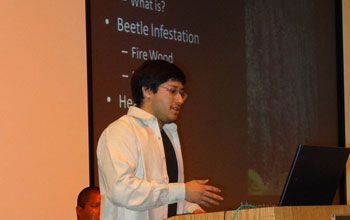
On
Nov. 6, 2012, the interns presented findings from their research
projects at the 2012 National Tribal GIS conference in Albuquerque, N.M.
In so doing, they gained experience in delivering professional
presentations. In addition, they spread the fruits of their research
to an audience of about 100 tribal geospatial professionals from across
the United States. To give the interns' presentations even greater
exposure, GIT posted them on the Internet.
During
their internships, the interns also received one-on-one mentoring from
scientists. "These internships are really eye-opening experiences for
students," said Porter. "Our interns will have the knowledge they gained
from these experiences for life."
Using real data
The
curriculum for GIT's 2012 session incorporated data from two important
NSF programs that are dedicated to long-term, large-scale, ecological
research. These programs are:
- The Long Term Ecological
Research Network (LTER), which supports a network of 26 ecologically
diverse field sites in the United States that are being studied over
extended temporal and spatial scales.
- The National Ecological
Observatory Network (NEON), which will be a massive nationwide
infrastructure used to simultaneously collect standardized ecological
measurements of variables, such as pollution levels, land use and
species diversity, at representative locations throughout the United
States over multiple decades. NEON measurements will enable scientists
to produce the first apples-to-apples comparisons of environmental
change across time and space throughout the United States. NEON
functions will be turned on incrementally until NEON becomes fully
functional in 2017.
GIT
exposed students to LTER and NEON data in various ways. For example,
LTER data was incorporated into each intern's research project. And NEON
and NEON-like data were covered in GIT workshops on GIS and
Photogrammetry & Mapping. In addition, several LTER researchers
delivered lectures and training to students on how to use LTER data.
Also,
during the summer of 2012, GIT interns visited NEON's headquarters in
Boulder, Colo. During this visit, the interns met NEON personnel,
toured NEON labs, and learned about high-tech sensing equipment used to
collect NEON's measurements.
By participating in these activities,
GIT students received preparation on how to use NEON data when it
becomes available. Also, they gained experience in linking
cutting-edge data from two of the nation's foremost ecological research
programs with real-world problems; they earned credentials that may
ultimately help them qualify for internships or jobs at NEON or
elsewhere; and they generated new professional connections.
"GIT
helps raise awareness within tribal communities of the wealth of
temporal information covering large geographic areas that will be
available as well as how it can be applied to tribal assessment and
long-term planning in order to help build resilient communities and
prepare for future climate events," said Porter.
For more information please contact: Liz Blood, NSF program manager, at lblood@nsf.gov or 703-292-4349.
|

No hay comentarios:
Publicar un comentario