Mostrando entradas con la etiqueta Colorado. Mostrar todas las entradas

domingo, 9 de julio de 2017

MEDIO AMBIENTE : CIENCIA .- BBC Mundo Noticias .- Por qué científicos en EE.UU. creen que es buena idea quemar terrenos de un parque nacional

http://www.bbc.com/mundo/noticias-40508079
http://www.cfsph.iastate.edu/Factsheets/es/enfermedad-debilitante-cronica.pdf    
http://www.tahc.state.tx.us/news/brochures/TAHCBrochure_CWD-Spanish.pdf
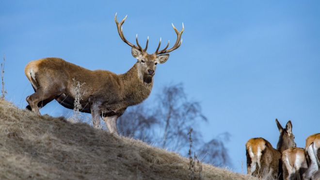
CiervoDerechos de autor de la imagen Getty Images
Image caption
                                    La enfermedad ya se ha registrado en 24 estados en Estados Unidos.
Quemar lotes de tierras del Servicio Nacional de Parques en Arkansas y Colorado, en Estados Unidos, es una muy buena idea, en opinión de Mark Zabel, doctor en Inmunología de la Universidad de Colorado.
Y es que estos incendios controlados -ya planificados por agencias ambientales con el objetivo de mejorar las condiciones de la vida silvestre en la zona- son para este investigador, un laboratorio donde poner a prueba una estrategia contra una misteriosa enfermedad que está devastando a poblaciones enteras de ciervos y alces.
Observada por primera vez en 1967 en EE.UU. por biólogos de su misma universidad, esta extraña enfermedad -denominada enfermedad debilitante crónica (EDC)- se ha esparcido ahora por 24 estados en ese país, y ha sido detectada Corea del Sur y en Noruega, que registró el primer caso en Europa en 2016.
 
La peculiaridad de esta enfermedad es que no está provocada por un virus o una bacteria sino por una proteína que se pliega de manera incorrecta, llamada prion, que, cuando se ingiere, hace que las otras proteínas en el cuerpo se comporten de la misma manera.
Las proteína priónicas son las que causan también las encefalopatía espongiformes transmisibles como la encefalopatía espongiforme bovina -la enfermedad de la vaca loca- y su variante en seres humanos, la enfermedad de Creutzfeldt-Jakob.

Síntomas

"Estas enfermedades se presentan generalmente con pérdida de memoria, demencia... son similares a otras enfermedades neurodegenerativas como el Alzheimer", le dice Zabel a BBC Mundo.
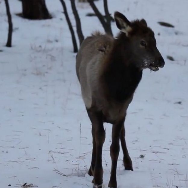
CiervoDerechos de autor de la imagen Mark Zabel
Image caption
                                    Los animales enfermos tienen dificultad para moverse, orinan y salivan mucho y le pierden el miedo a los depredadores y humanos.
"En el caso de la EDC, estos animales tienen las orejas caídas, salivan y orinan mucho, tienen gran dificultad para iniciar sus movimientos, pierden peso y el miedo a los depredadores y a los humanos", añade.
No hay ni cura ni vacuna para proteger a los animales y, hasta donde se sabe, una vez que el animal manifiesta los síntomas, siempre es mortal.
Además, es una de las enfermedades priónicas más difíciles de controlar: cuando hay un animal enfermo, en el largo plazo puede acabar contagiando a la mayor parte de la manada.
Hasta el momento no hay evidencia de que pueda saltar especies y contagiarse de cérvidos a humanos. No obstante, como es una enfermedad en evolución, el temor es que pegue el salto.

Incendios

La razón por la que Zabel y su equipo creen que la quema de terrenos puede ser un elemento clave en la estrategia para evitar la propagación la EDC, es por el modo en que se contagia.
Si bien la transmisión por el contacto directo entre animales (a través de la saliva de hocico a hocico, pero también por las heces o la orina) es el mecanismo más importante, no es el único.
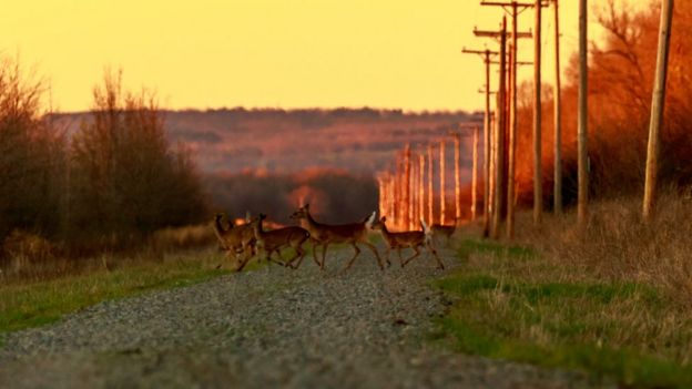
CiervosDerechos de autor de la imagen Getty Images
Image caption
                                    Los priones son muy estables y quedan por décadas en el medioambiente                
"Los priones son increíblemente estables, pueden quedar en el ambiente por décadas. Puedes sacar a los animales infectados y reintroducir animales sanos años después, y estos contraerán la enfermedad", dice el inmunólogo.
Un método que podría funcionar para reducir el número de priones en el medio ambiente, cree Zabel, es quemando el terreno.
Y como los incendios en su área de estudio ya estaban planificados, el investigador quiere aprovechar la oportunidad para analizar la presencia de priones en las plantas antes y después de la quema.
La temperatura generada por los incendios no es lo suficientemente alta como para eliminarlos por completo, pero la disminución de su población puede reducir las chances de que se contagien animales sanos.
Por otra parte, "cuando las plantas se queman y los priones se depositan nuevamente en el suelo, hay ciertos componentes del suelo que los mantienen de forma muy apretada. Si esto ocurre, es posible que las plantas que vuelven a crecer en esos suelos no incorporen esos priones en la estructura de sus raíces", señala Zabel.
El científico no descarta que pueda ocurrir todo lo contrario. Es decir que el impacto de la quema sea negativo: si los animales consumen suelo para suplir una deficiencia de minerales, los priones en la tierra acabarían infectándolos.
La única forma de saberlo, es experimentando con los incendios controlados

Temas relacionados

Guillermo Gonzalo Sánchez Achutegui
ayabaca@gmail.com
ayabaca@Hotmail.com
ayabaca@yahoo.com
Inscríbete en el Foro del blog y participa : A Vuelo De Un Quinde - El Foro!

viernes, 20 de diciembre de 2013

NSF.GOV - National Science Foundation - Mountain pikas, relatives of rabbits, survive at warm sea-level temperatures by eating mosses

Mosses also may protect high-peak pikas against climate change effects
a pika peers out from behind thick moss in Oregon's Columbia River Gorge.
A small mammal known as a pika peers out from behind thick moss in Oregon's Columbia River Gorge.
Credit and Larger Version
December 18, 2013
In some mountain ranges, Earth's warming climate drives rabbit relatives known as pikas to higher elevations--or wipes them out.
But biologists discovered that pikas living in rockslides near sea level in Oregon can survive hot weather by eating moss.
"Pikas eat foods like moss to persist in warming environments," says biologist Denise Dearing of the University of Utah, co-author of a new paper reporting the results. The paper is published online today in the Journal of Mammalogy.
Jo Varner, also a biologist at the University of Utah and a paper co-author, says that although "some fiber is good, moss is 80 percent fiber. It's a bit like eating paper.
"By consuming mosses that grow on the rockslides where they live, the pikas don't have to forage outside the shady heat-buffer of the rocks.
"Few herbivores consume moss because it's so nutritionally deficient. These pikas set a new record for moss in a mammal's diet: 60 percent."
Pikas' extensive moss-eating "suggests that they may be more resistant to climate change than we thought," says Dearing.
The biologists, whose research was funded by the National Science Foundation (NSF), believe they know why.
Like rabbits and hares, pikas produce a fraction of their feces in the form of caecal (pronounced see-cull) pellets, and reingest them to gain nutrition.
"Pikas and rabbits--and their gut microbes--are the ultimate recycling factory," Dearing says. "They ingest low-quality food over and over again, and turn it into high-quality protein and energy. The end product is six times more nutritious than the moss" that started it all.
The order Lagomorpha, to which pikas belong, has two families: one is made up of rabbits and hares, the other of pikas.
Pikas are native to cold, alpine climates--often above 8,200 feet--in North America, Asia and Eastern Europe.
Pikas are very sensitive to heat, dying if they spend more than two hours above 78 degrees Fahrenheit.
In parts of the West--including Nevada, Oregon and Colorado--pikas have gone extinct in some mountain ranges and moved to higher peaks in others.
Pikas live as high as 11,230 feet on the slopes of Mount Hood east of Portland, Ore. They also live thousands of feet down the north slope of Mount Hood in the wet, foggy Columbia River Gorge.
How do they exist in warmer places like the gorge? By living in rocks on moss-covered slopes, the researchers found.
The scientists conducted their study on two such slopes near Wyeth, Ore., from June through August, 2011 and 2012. Pikas are most active in the summer months.
The biologists surveyed the abundance of mosses, lichens, ferns, grasses, sedges, rushes, forbs, shrubs and trees in the rockslides. They found that the slopes were 60 percent to 70 percent covered by vegetation.
Samples of the pikas' food were analyzed for how much the animals ate, and for the food's nutrition and fiber content.
Sixty percent of the pikas' diet by dry weight came from mosses. The pikas favored two species: hoary rock moss and big red-stem moss.
"This study represents the highest degree of voluntary moss consumption reported for a mammalian herbivore in the wild," Dearing and Varner write in their paper.
For temperature-sensitive pikas, cool, green mosses--whether atop a mountain or at the bottom of a gorge--are life-rings.
The research was also funded by the University of Utah, Wilderness Society, Southwestern Association of Naturalists, Society for Integrative and Comparative Biology, and American Society of Mammalogists.
-NSF-
Media Contacts Cheryl Dybas, NSF, (703) 292-7734,
 cdybas@nsf.gov
Lee Siegel, University of Utah, (801) 581-8993,
Related WebsitesNSF Award: Graduate Research Fellowship Program-Varner:
 https://www.fastlane.nsf.gov/grfp/AwardeeList.do?method=loadAwardeeList
NSF Discovery Article: The Search for White Gold--High-Mountain Snow:
The National Science Foundation (NSF) is an independent federal agency that supports fundamental research and education across all fields of science and engineering. In fiscal year (FY) 2012, its budget was $7.0 billion. NSF funds reach all 50 states through grants to nearly 2,000 colleges, universities and other institutions. Each year, NSF receives about 50,000 competitive requests for funding, and makes about 11,500 new funding awards. NSF also awards about $593 million in professional and service contracts yearly.
Useful NSF Web Sites:
NSF Home Page:
 http://www.nsf.gov
NSF News:
 http://www.nsf.gov/news/
For the News Media:
 http://www.nsf.gov/news/newsroom.jsp
Science and Engineering Statistics:
Pika next to a down tree
Researchers discovered that high-elevation pikas survive at sea-level by eating moss.
Credit and Larger Version
A pika sits among rocks and moss
A pika sits among rocks and moss; on high peaks, pikas are threatened by global warming.
Credit and Larger Version
Biologist Jo Varner collects vegetation from the haypiles pikas build under rockpiles
Biologist Jo Varner collects vegetation from the "haypiles" pikas build under rockpiles in winter.
Credit and Larger Version
Jo Varner and Denise Dearing in a lab
Jo Varner and Denise Dearing found that pikas may be able to adapt to climate change.
Credit and Larger Version
 
The National Science Foundation (NSF)
Guillermo Gonzalo Sánchez Achutegui

lunes, 25 de marzo de 2013

NASA - An Astronauts View of the Colorado Plateau


 This astronaut photograph highlights part of the Utah-Arizona border region of the Plateau, and includes several prominent landforms.

Download Image

› Full Size 
NASA
Guillermo Gonzalo Sánchez Achuteguui
ayabaca@gmail.com
ayabaca@hotmail.com
ayabaca@yahoo.com
Inscríbete en el Foro del blog y participa : A Vuelo De Un Quinde - El Foro!

domingo, 24 de marzo de 2013

NASA - First Images Released From Newest Earth Observation Satellite


A Closer Look at LDCM's First Scene
03.21.13
 
Turning on new satellite instruments is like opening new eyes. This week, the Landsat Data Continuity Mission (LDCM) released its first images of Earth, collected at 1:40 p.m. EDT on March 18. The first image shows the meeting of the Great Plains with the Front Ranges of the Rocky Mountains in Wyoming and Colorado. The natural-color image shows the green coniferous forest of the mountains coming down to the dormant brown plains. The cities of Cheyenne, Fort Collins, Loveland, Longmont, Boulder and Denver string out from north to south. Popcorn clouds dot the plains while more complete cloud cover obscures the mountains.
http://www.nasa.gov/images/content/736089main_fortcollins_oli_2013077_1080_labeled.jpg
http://www.nasa.gov/images/content/736092main_fortcollins_oli_2013077_swir_1080_labeled.jpg 
 
http://www.nasa.gov/images/content/736089main_fortcollins_oli_2013077_1080_labeled.jpg  
Click and drag the slider bar to compare these LDCM images, which zoom into the area around Fort Collins, Colo. On the left, the image is shown in natural color, created using data from OLI spectral bands 2 (blue), 3 (green), and 4 (red). The image on the right was created using data from OLI bands 3 (green), 5 (near infrared), and 7 (short wave infrared 2) displayed as blue, green and red, respectively. In the left-hand natural color image, the city's elongated Horsetooth Reservoir, a source of drinking water, lies west of the city. A dark wildfire burn scar from the Galena Fire is visible just to the left of the reservoir. The scar shows up bright, rusty red in the false color image.
Credit: USGS/NASA Earth Observatory
› Download left image | unlabeled version
› Download right image | unlabeled version

LDCM is a joint mission of NASA and the Department of Interior's U.S. Geological Survey.

"It's a really great day," said Jeff Pedelty, an instrument scientist at NASA's Goddard Space Flight Center in Greenbelt, Md., who worked on the LDCM Operational Land Imager, or OLI instrument, that took the natural color image. He's very impressed with the level of detail they can see with the advancements to the sensor. "It's wonderful to see, there's no doubt about it, and it's a relief to know that this is going to work wonderfully in orbit."

The natural color image showed the landscape in the colors our eyes would see, but Landsat sensors also have the ability to see wavelengths of light that our eyes cannot see. LDCM sees eleven bands within the electromagnetic spectrum, the range of wavelengths of light. OLI collects light reflected from Earth's surface in nine of these bands. Wavelengths on the shorter side include the visible blue, green, and red bands. Wavelengths on the longer side include the near infrared and shortwave infrared.

LDCM's second instrument, the Thermal Infrared Sensor (TIRS) detects light emitted from the surface in two even longer wavelengths called the thermal infrared. The intensity of the emitted light at the longer wavelengths measured by TIRS is a function of surface temperature. In the black-and-white image of the first thermal band on TIRS, warmer areas on the surface are brighter while cooler areas are dark.

The first thermal images seen by Dennis Reuter, TIRS instrument scientist at Goddard, were forwarded to him from the data processors. "To say it was exciting was an understatement," said Reuter, who was blown away by the data quality. "Wow! This is beautiful!" he wrote in an email. "Look at those amazing clouds! And the detail!"

Clouds in the colder upper atmosphere stand out as black in stark contrast to a warmer ground surface background. The TIRS images were collected at exactly the same time and place as the OLI data, so all eleven bands can be used together.

diagram illustrating how LDCM observations at different wavelengths are combined to create one image
This diagram illustrates how LDCM's observations at different wavelengths are combined to create one image.
Credit: NASA's Goddard Space Flight Center
› Larger image

The infrared bands on both TIRS and OLI complement the visible bands, said Reuter. "You're seeing things in the visible that you don't necessarily see in the infrared, and vice versa," he said.

Different characteristics on the ground dictate the intensity of the reflection and emission of light in different bands from the surface, ultimately allowing scientists to distinguish between different surface features. To highlight differences across an image, analysts sometimes assign artificial colors to data from different spectral bands for display.

For example, zooming in to the area around Fort Collins, Colo., the natural color image was created from OLI bands 2 (blue), 3 (green), and 4 (red) data. In the image, a dark stripe can be seen just west of the Horsetooth Reservoir, a source of drinking water for the city. The stripe is a scar left in the aftermath of the Galena wildfire. That same burned area bursts out of the image as a bright, rusty red scar with greater contrast between the surrounding areas in the false color image. The false color image was created using data from OLI bands 3 (green), 5 (near infrared), and 7 (short wave infrared 2), assigned the colors blue, green and red respectively. These types of LDCM images and the accompanying data will be used by multi-agency Burned Area Emergency Response teams to plan and carry out wildfire recovery measures.

Similarly, the thermal bands that detect wavelengths dependent on surface temperature show more than just high altitude clouds. This ability to measure differences in temperature across the land surface is essential to one of the major applications of LDCM data: water management. Analysts in western states will use TIRS data in conjunction with OLI data to determine the amount of water being used in irrigated agricultural fields.

black-and-white LDCM scene of Boulder-Fort Collins area in Colorado
This black-and-white Landsat scene shows the area where the Great Plains meet the Front Range of the Rocky Mountains in Wyoming and Colorado. The image was created using data from the first TIRS thermal infrared band. Warmer surfaces appear light gray to white in the thermal image while cooler areas appear dark gray to black. Clouds in the colder upper atmosphere, for instance, appear black against the lighter background of the warmer ground surface. When the satellite begins normal operations, data products will contain co-registered (simultaneous) data for all of the OLI and TIRS.

Note to Landsat data users: This scene is slightly off set from the standard Path 33, Row 32 Landsat scene as LDCM has not yet reached its nominal 438-mile (705-kilometer) operational orbit.

Credit: USGS/NASA Earth Observatory
› Larger image (12 MB tif)

"When you water plants they take it in through their roots and it comes up to their leaves, and if they have a plentiful water supply, they transpire," said Reuter. Transpiration, as well as evaporation from the soil, means that the water goes back into the atmosphere.

"It's just like when we sweat, we cool down. [Plants] cool down when they have a lot of water," said Reuter. "It's a beautiful illustration of the physics of radiative transfer and also the usefulness of the data." This application of LDCM data will be essential to the effective management of scarce water resources in our arid and semi-arid states.

LDCM image of the Fort Collins/Boulder area LDCM captured this image on March 18, 2013, the first day that OLI observed Earth from space. This natural color Landsat scene was created using data from OLI spectral bands 2 (blue), 3 (green) and 4 (red), and it emulates the true colors the human eye would see from space. The data were collected at the same time as the TIRS data in the black-and-white image. Both Reuter and Pedelty were impressed with the level of detail they see in the OLI and TIRS data. Part of that detail comes from the push broom design of both instruments. Instead of instruments that scan back and forth across a swath on the ground, push broom data collection looks across whole swath at once, allowing the sensors to observe each patch of ground longer. "It's like taking a thermometer and letting it sit there longer to get a more stable measurement," said Reuter. But the work is only beginning for validating the data quality and getting ready for normal mission operations. These images were processed using pre-launch settings, which must be checked and adjusted now that LDCM is in orbit to ensure that the data accurately measure the intensity of reflected and emitted light received by the instruments. The mission operations team also needs to ensure that each pixel is accurately located on Earth's surface. Among the first activities planned in the next two months are reference checks for both OLI and TIRS. OLI will look indirectly at the sun with its solar diffuser panel. "We let the sun shine on the panel so it makes a bright uniform target and we image that," said Pedelty, who adds that while it may seem mundane compared to an image of Earth, it's a key reference measurement for updating OLI's calibration. In addition, for both OLI and TIRS calibration, LDCM will view deserts, the ocean and the moon, surfaces with relatively stable and well-known reflectance and emittance properties. The mission operations team also plans to fly underneath the currently orbiting Landsat 7 to collect data at the same time in order to cross-calibrate the two LDCM sensors with the Landsat 7 Enhanced Thematic Mapper-Plus (ETM+) instrument. "Everything has been very exciting," said Reuter. These first images are the culmination of a lot of hard work from the people at NASA and USGS, the Landsat Science Team and their industry partners at Ball Aerospace Corp. in Boulder, Colo., that built OLI, and Orbital Science Corp. of Gilbert, Ariz., that built and tested the spacecraft, he said. "As a tool for science, for looking at the whole planet and seeing how we're affecting it, and how it's affecting us, it's gratifying in all ways." Pedelty agrees. "I was privileged to work onsite at Ball Aerospace as they designed, built and tested the OLI. Then I moved to Orbital Sciences to help test the LDCM observatory. A lot of talented people worked very hard and everything had to work. And it has." LDCM's normal operations are scheduled to begin in late May when the instruments have been calibrated and the spacecraft has been fully checked out. At that time, NASA will hand over control of the satellite to the USGS, which will operate the satellite throughout its planned five-year mission life. The satellite will be renamed Landsat 8, and data from OLI and TIRS will be processed and added to the Landsat Data Archive at the Earth Resources Observation and Science Center in South Dakota, where it will be distributed for free over the Internet.


Note to Landsat data users: This scene is slightly off set from the standard Path 33, Row 32 Landsat scene as LDCM has not yet reached its nominal 438-mile (705-kilometer) operational orbit.


Credit: USGS/NASA Earth Observatory

› Larger image (32 MB jpg)


LDCM image of Boulder, Colo., area
The area around Boulder, Colo., is shown here in a true color image collected by the OLI aboard LDCM on March 18, 2013. The OLI and an important component of TIRS, its cryocooler, were built at the Ball Aerospace & Technologies Corporation facility in Boulder.
Credit: USGS/NASA Earth Observatory
› Download larger image | unlabeled version


Related Links


› NASA press release: "First Images Released from Newest Earth Observation Satellite"
› NASA Earth Observatory: "First View from the New Landsat Satellite"
› NASA's LDCM website
› USGS Landsat website


Ellen Gray
NASA's Earth Science News TeamNASA
Guillermo Gonzalo Sánchez Achutegui
ayabaca@gmail.com
ayabaca@hotmail.com
ayabaca@yahoo.com
Inscríbete en el Foro del blog y participa : A Vuelo De Un Quinde - El Foro!

martes, 16 de octubre de 2012

NSF Investments Develop a Workforce for Sustainability Research and Education


The research of one SEES Fellow, Sarah Jane White of Harvard's School of Public Health, examines metal-rich acid mine drainage coming from a mine adit near Lake Fork Creek, Colo. For emerging metal contaminants like indium, gallium, germanium, and tellurium, releases from mining and smelting processes are thought to be the largest releases of these metals to the environment.
Credit: Sarah Jane White, Harvard School of Public Health
Download the high-resolution JPG version of the image. (786 KB)
The National Science Foundation's SEES Fellows program today announced 20 new awards that address research questions at the core of environmental and economic sustainability and human well-being.
The SEES Fellows program is part of an NSF portfolio called "Science, Engineering and Education for Sustainability," or SEES. The awards will enable promising early-career researchers to establish themselves in independent research careers related to sustainability.
From the practicality of solar energy, the efficacy of biofuels tax policy, techniques in food sustainability and genome sequencing, to ways to promote the health of shoreline ecosystems and mitigate the health effects of understudied metals and their byproducts, this year's Fellows will embark on a diversity of research questions important for America's future.
The SEES Fellows program aims to facilitate investigations that cross traditional disciplinary boundaries and address issues of sustainability through a systems approach, building bridges between academic inquiry, economic growth and societal needs.
A SEES Fellow's proposed investigation must be interdisciplinary and allow him or her to obtain research experiences beyond the researcher's current core disciplinary expertise. Fellows must develop research partnerships that advance and broaden the impact or scope of the proposed research and present a plan for their own professional development in the area of sustainability science and engineering.
The complete list of awards, primary institutions and principal investigators follow below:
This study will develop metrics and measurement tools for quantitatively and spatially capturing data on social and cultural human values that can be incorporated into environmental planning, urban development and other land-use decision-making contexts.
This project will explore the impacts of changes in land cover and land use in northwestern Mexico on moisture recycling and transport to both the United States and other areas of Mexico using a coupled land-atmosphere model.
This research will focus on integrating engineering, environmental, economic and policy concepts to biofuels tax policy. A detailed survey of biofuels producers will be used to collect information on the nature of existing market failures, applying models to verify and assess the effectiveness of various tax proposals at multiple scales.
This project will explore the relationship between soil, climate and production variables in predicting agricultural greenhouse gas emissions from U.S. swine production. Results will be incorporated into a nationwide life cycle assessment of the U.S. swine and pork industry.
This research will develop solar windows consisting of semitransparent Luminescent Solar Concentrators with optimized efficiency for the utilization of electrical, chemical and thermal solar energy.
This project will leverage high-performance computing to assess key challenges of climate change. The overall goal is to improve understanding of the interactions of climate and socio-economic changes on agricultural commodities, local land use and land cover, and regional and global food sustainability.
This research will address the regulation and economics of shale-gas development to develop an approach for choosing regulations that minimize risk to the environment while allowing for robust development of shale-gas reserves.
This study will integrate the approaches of industrial and political ecology to assess re-localization efforts--a movement to encourage sustainable production and consumption of food, energy and goods--in Hawaii, and their implications for sustainability.
This project will develop statistical methods to enable ecologists to address critical problems in biodiversity modeling, to advance understanding of key aspects of species distributions that can guide conservation efforts.
This research will use advanced genomic sequencing techniques to investigate how biological control agents are established, undergo genetic variation, and adapt to novel environments.
This project will explore the motivations for and outcomes associated with the stewardship of so-called sustainable yard practices--that is, ways to reconcile urban environmental integrity.
This research will investigate a novel approach for converting environmentally-detrimental wastewater nutrients into fertilizing biomass and commodity chemicals.
This study will probe the technical and social challenges of implementing a water reuse technology that integrates the processes of energy production, wastewater treatment and drinking water purification.
Sustainable Energy Infrastructure Planning-- Roshanak Nateghi, Johns Hopkins University
This project will assess the design of a new generation of policy incentives for sustainable modernization and expansion of U.S. electric power infrastructure, a climate resilient infrastructure that can meet society's projected future energy demands.
This research will explore the technological, environmental and socio-economic barriers to adopting solar power, now used to supply only about one-tenth of one percent of worldwide energy demand, despite its having the greatest potential of any sustainable resource.
By studying the Narragansett and Mobile Bays, both large, densely-populated areas that have experienced dramatic declines in nearshore marine habitats, this project will investigate how social, ecological and engineering factors may contribute to coastal resilience.
This research will assess the role of landscapes in maintaining and protecting aquatic resources while allowing for land development and examine how patterns of stream fish and insect community composition relate to land-use patterns at different scales.
This study will explore how socio-economic and soil fertility factors interact to generate unsustainable agricultural practices in Uganda, how the trend of productivity loss might be reversed and how the reversal of productivity declines can be used to protect the Albertine Rift, including Kibale National Park, one of the Earth's most valuable biodiversity resources.
This project aims to expand understanding of how social-ecological systems adapt to change in terms of natural resource use, examining a model island system, the Hawaiian ahupuaa (a traditional Hawaiian unit of land division which organized human communities along watershed boundaries).
This research will address the need for the early assessment of novel industrial materials--understudied metals and their byproducts--that will be used in future semiconductors in order to prevent future adverse environmental and human health impacts.
Information on the FY 2013 SEES Fellows competition can be found on the program website. The proposal deadline is November 26, 2012.
-NSF-
Media Contacts Lisa-Joy Zgorski, NSF (703) 292-8311 lisajoy@nsf.gov
Program Contacts Larry H. Weber, NSF (703) 292-8580 lweber@nsf.gov
Related Websites
The National Science Foundation (NSF) is an independent federal agency that supports fundamental research and education across all fields of science and engineering. In fiscal year (FY) 2012, its budget is $7.0 billion. NSF funds reach all 50 states through grants to nearly 2,000 colleges, universities and other institutions. Each year, NSF receives over 50,000 competitive requests for funding, and makes about 11,000 new funding awards. NSF also awards nearly $420 million in professional and service contracts yearly.
Useful NSF Web Sites:
NSF Home Page: http://www.nsf.gov
NSF News: http://www.nsf.gov/news/
For the News Media: http://www.nsf.gov/news/newsroom.jsp
Science and Engineering Statistics: http://www.nsf.gov/statistics/
Awards Searches: http://www.nsf.gov/awardsearch/
 The National Science Foundation (NSF).
Guillermo Gonzalo Sánchez Achutegui
ayabaca@gmail.com
ayabaca@hotmail.com
ayabaca@yahoo.com 
 Inscríbete en el Foro del blog y participa : A Vuelo De Un Quinde - El Foro!

domingo, 1 de julio de 2012

USA: Waldo Canyon Fire


Download Image

› Full Size 

 NASA
 Guillermo Gonzalo Sánchez Achutegui
 ayabaca@gmail.com
 ayabaca@hotmail.com
 ayabaca@yahoo.com
 Inscríbete en el Foro del blog y participa : A Vuelo De Un Quinde - El Foro!

martes, 24 de febrero de 2009

HUANCABAMBA....................UNA BELLA TIERRA CON MUCHOS MITOS. CAPÍTULO Nº I . EL NEGRO Y SU AMADA

Hola amigos: A VUELO DE UN QUINDE EL BLOG., como yo nací en Socchabamba, Provincia de Ayabaca, Departamento de Piura, estoy identificado con todas las vivencias que suceden en el Alto Piura, donde se ubican: Ayabaca, Huancabamba y Morropòn; una vez más gracias a mi dilecto amigo huancabambino Don Moisés Gonzalo Cordova Guerrero (imagen de la izquierda, el Señor de la izquierda, siendo el de la derecha es el autor de este tema, estamos en la puerta de su casa en Chiclayo) residente en Chiclayo, me ha hecho llegar llegar una recopilación de "MITOS Y LEYENDAS" de Huancabamba; un trabajo literario realizado por Ray Angus. Gerente General del Proyecto Cuprífero Majaz.-Proyecto Río Blanco, editado por la Editorial Universitaria de la Universidad Nacional "Federico Villarreal" de Lima de Enero de 2,006; realmente este trabajo va a gustar a los lectores aficionados a los mitos y leyendas que viene hacer el lenguaje popular que caracteriza a cada pueblo, y con más vigor tienen en Huancabamba tierra ya muy famosa por contar con las enigmáticas Lagunas de Las Huaringas, cuyas aguas gozan de misteriosos poderes curativos según la creencia popular. Ahora empezamos relatando un amor entre dos razas diferentes........................

-----------------EL NEGRO Y SU AMADA-------------------
Hasta nuestros días se dice que en caserío de Socchapampa, cada año---- en el Día de los Muertos--- se aparecen El Negro y su Amada.
En la época de la conquista, cuando los españoles habitaban Huancabamba y sus alrededores, se trajeron esclavos para que hicieran trabajos forzados.
Se sabía que ningún esclavo podía mirar a una blanca (española) porque sería castigado con la muerte.
No obstante, y como siempre, no podía faltar uno que se enamoró de la hija de sus patrones, quienes vivían en una casa grande de Socchapampa, la que hoy pertenece a la familia Guerrero Núñez, y para colmo la joven también se enamora del esclavo. Ambos se enredan en un romance que solo les permitía verse a escondidas --- por las noches--- en la Loma Jumbo, que hasta hoy existe y es presa de una serie de misterios. Se llama así debido a una planta del mismo nombre, que se ubica en el centro de la loma, la que si se le mira de noche tiene apariencia de personas de acuerdo a la oscuridad o a la luz de la luna.
Cuando podían se juntaban, el esclavo con su amada --- La Blanca--- , a reposar a la sombra de la planta Jumbo. A pesar de sus diferencias, ellos se amaban profundamente; entre ellos había esa química que no tiene cualquier pareja.
Los padres de la joven empezaron a sospechar, pues de la nada desaparecían ambos a la vez. Pero su orgullo era tan grande que se dijeron: "Eso no es cierto, nunca ocurriría algo así con nuestra hija. Ella sabe lo que le pasaría a ella y la negro esclavo, sabe muy bien que ambos morirían".
En aquellos tiempos a todo aquel que cometiese algo parecido se le enterraba vivo. Sin embargo, aun así enviaron a otros esclavos a seguir los movimientos de su hija y del esclavo. La joven, como era astuta, se dio cuenta enseguida, esquivando a sus perseguidores.
Pero un día se descuidaron y fueron descubiertos por uno de los esclavos, quien inmediatamente fue a decir lo visto a los padres de la chica. Los señores trataron de esconder lo sucedido pues amaban a su hija, pero no pudieron seguir haciéndolo ya que la mayoría de gente española rápido se había enterado.
Ya era el 31 de octubre, y solo habían pasado unos días desde el momento en que fueron encontrados infortunadamente los amantes. Como los comentarios eran grandes y el castigo no se podía retrasar, las autoridades determinaron -- finalmente -- que el día primero de noviembre el esclavo y la hija de los españoles serian enterrados vivos, pero por separado para que ni siquiera en agonía pudieran verse.
Se resuelve que le negro sea enterrado en una cueva del cerro Colorado, y la joven española llevada a una de las cuevas de la Manga Manga. Ambos, antes de morir, solo pudieron darse un beso y gritarse amor eterno con la mirada. Extrañamente, los padres desaparecieron del caserío de Socchapampa; se cree que por cuenta propia decidieron regresar a nuestra capital, aunque algunos pobladores comentan que lo que pasó con ellos fue que, al no soportar la pérdida de su única hija, ambos decidieron suicidarse.
La Loma Jumbo, con el pasar de los años, fue convertida en cementerio ( en la actualidad ya no lo es) : los dueños han encontrado restos humanos en este lugar.
Desde la fecha en que ambos amantes fueron enterrados vivos, se dice que cada año, el día primero de noviembre, ambos salen de sus tumbas encontrándose en un lugar neutral entre ambas cuevas en las que fueron enterrados, y realizan su recorrido par allegar al lugar que por mucho tiempo albergó su romance; Loma Jumbo.
En el trayecto entonan canciones que atraen a cualquier vagabundo que se encuentre por estos lugares. En el caso de que alguien se acercara a verlos, sería arrastrado y enterrado vivo en el mismo lugar. Aun después de muertos, el esclavo y la blanca española no pueden estar tranquilos en sus encuentros anuales, pues continúan con el dolor de haber sido asesinados por AMARSE, y como una forma de auto defensa es que matan a los curiosos que pretenden verlos.Esta también es una de las razones, como dice Edgar, por la que ellos encuentran restos humanos en su terreno.
Guillermo Gonzalo Sánchez Achutegui
ayabaca@gmail.com
ayabaca@hotmail.com
ayabaca@yahoo.com

Mi lista de blogs